Merrymeet
| Merrymeet | |
| Cornwall | |
|---|---|
 Merrymeet | |
| Location | |
| Grid reference: | SX280660 |
| Location: | 50°28’7"N, 4°25’29"W |
| Data | |
| Local Government | |
| Council: | Cornwall |
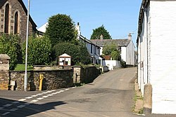
Merrymeet is a tiny village in the parish of Menheniot in Cornwall. Menheniot itself lies some two miles to the south, but Merrymeet is more familiar to travellers as the delightfully named hamlet on the main road, the A390 between Callington and Liskeard. It is on that road perched halfway between the Rivers Tiddy and Seaton, a mile and a half or so out of Liskeard.
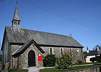
The Church of St Mary the Virgin was built as a mission church. It was opened in 1905 to serve the needs of the people in this far corner of Menheniot Parish, and remains officially the mission church of St Lalluwy's Menheniot.
There is also a a Methodist church.
References
