Cardross
| Cardross | |
| Dunbartonshire | |
|---|---|
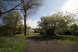
 Geilston House, by Cardross | |
| Location | |
| Location: | 55°58’0"N, 4°37’60"W |
| Data | |
| Population: | 1,925 (2001) |
| Local Government | |
Cardross is a large village in Dunbartonshire; it had a population of 1,925 in 2001. It stands on the north side of the Firth of Clyde, halfway between Dumbarton and Helensburgh. Cardross gives a name also to the parish, where King Robert the Bruce once lived. The Parish area stretched from the west side of Dumbarton to Camus Eskan (near Helensburgh) and even as far as Loch Long and also included the village of Renton in the Vale of Leven.
History
Robert the Bruce purchased the portions of lands of Pillanflatt from the Earl of Lennox, lying in the parish of Cardross in 1326. In 1329, he died at his manorial house that he built there. A field called the Mains of Cardross is thought to have been the location of his royal manor.[1]
Natural History
A mile northwest of Cardross is a peninsula called Ardmore Point. This privately owned area of land has a nature trail and is considered a Regionally Important Geographical Site (RIGS) due to unique rock formations including an exposed sea cliff.[2] It is a popular fishing and bird-spotting area[3][4] and grey seals can also be seen here.[5]
Facilities
There are a number of shops, including a post office, newsagents, pharmacy, plumber's merchant and a café.
Ardardan Estate[6] is a working farm with a farm shop, plant nursery and tea room and is situated just outside Cardross near Ardmore Point.
Sports
The town possesses a golf course, bowling, tennis and football clubs.
Transport links
Cardross railway station has direct links to both Glasgow Queen Street and Edinburgh Waverley stations on the North Clyde Line.
About the village
Geilston Garden, a National Trust for Scotland property, is located to the north west of the village.
There are nearly fifty listed buildings/structures in Cardross, two of which are category A.
Structures of note include:
- The 14th century St. Mahew's Chapel. Most recently restored in the 1950s as a Roman Catholic church which remains in use.[7]
- The former St Peter's Seminary, designed by Gillespie, Kidd & Coia, is situated to the north of the village; it is closed to the public. Abandoned in the late 1980s, it is in a state of dilapidation, particularly internally. Its future is uncertain.[8]
- The ruined 15th century Kilmahew Castle that was built by the Napier Clan is situated just north of the village.
- The main road through the village goes over Moore's Bridge (1688)
Churches
- Church of Scotland: Cardross Parish Church
- Roman Catholic: Saint Mahew
The original parish church was bombed during the Second World War and its ruins are located next to the manse.
| ("Wikimedia Commons" has material about Cardross) |
References
- ↑ Strathleven Artizans: Robert the Bruce King of Scots
- ↑ The Geology of Ardmore Point
- ↑ http://www.google.co.uk/#sclient=psy&hl=en&source=hp&q=fishing+ardmore+point&aq=f&aqi=g-v1&aql=&oq=&pbx=1&bav=on.2,or.r_gc.r_pw.&fp=3788568279b141cc&biw=1280&bih=665
- ↑ "Clydebirds". Clydebirds. http://www.clydebirds.co.uk/BIRDING-SITES.php. Retrieved 2011-11-03.
- ↑ "Ardmore Point, near Helensburgh". Walkhighlands. http://www.walkhighlands.co.uk/lochlomond/ardmore-point.shtml. Retrieved 2011-11-03.
- ↑ Ardardan Estate
- ↑ St Mahew's
- ↑ Historic Scotland's Statement of Significance for St. Peter's
Sources
- "Ardardan Estate: Welcome to Ardardan". http://ardardan.co.uk/. Retrieved 31 December 2010.
- "Strathleven Artizans: Cardross". http://www.strathlevenartizans.com/card.htm. Retrieved 31 December 2010.
- "Area Profile of 46 Ward Cardross (Argyll and Bute 2001 Census Factsheets)". http://www.argyll-bute.gov.uk/pdffilesstore/stats46cardross?a=0.
- "The Geology of Ardmore Point". http://www.hmag.gla.ac.uk/neil/geology/RIGS/Ardlflt6b.pdf. Retrieved 31 December 2010.
- "Strathleven Artizans: Robert the Bruce King of Scots". http://www.strathlevenartizans.com/brucefact.htm. Retrieved 31 December 2010.
- "Hermitage Academy web page". http://www.hermitageacademy.argyll-bute.sch.uk/index.htm.
- "Cardross Golf Club". http://www.cardross.com.
- "Historic Scotland's Statement of Significance for St. Peter's". http://www.historic-scotland.gov.uk/avanti-chap3-stpeters.pdf#xml=http://web1:10700/texis/webinator/search/pdfhi.txt?query=Cardross&pr=default1&prox=page&rorder=500&rprox=500&rdfreq=500&rwfreq=500&rlead=500&rdepth=0&sufs=0&order=r&cq=&id=4a13649e9. Retrieved 31 December 2010.