St Tudwal's Islands
| St Tudwal's Islands Welsh: Ynysoedd Tudwal | |
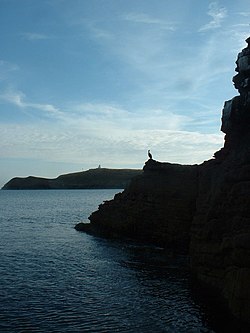
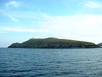
 St Tudwal's Island East with West behind | |
|---|---|
| Location | |
| Highest point: | St Tudwal's Island East, 125 feet |
| Data | |
St Tudwal's Islands are a small group of islands lying south of Abersoch on the Llŷn peninsula in Caernarfonshire, at the western end of Tremadog Bay. They were apparently referred to as the Studwells in the early 19th century.[1][2]
There are two main islands and other islets:
- St Tudwal's Island East (Ynys Tudwal Fach) at SH341259
- St Tudwal's Island West (Ynys Tudwal Fawr) at SH334251
- The Carreg y Trai rocks (SH349256)
The East island is currently owned by author Carla Lane and the West island was recently purchased by adventurer Bear Grylls and converted into a holiday home.
The islands are known for their seal population. The western island has a lighthouse, and the eastern has the remains of a priory.
The sheltered bay of Abersoch north of St Tudwal’s Islands is known as St Tudwal’s Road.
St Tudwal's Island East
Saint Tudwal's Island East is a grass covered, privately owned, kidney-shaped island, about 500 yards long and 200 yards broad. Small ships sail from the nearby town of Abersoch to take passengers to view the wildlife.
The highest point on the island is 125 feet above sea level. It is located less than a mile off Llŷn. The nearest village is on the mainland at Machroes.
The island is believed to be the original hermitage of Saint Tudwal, which is presumably where its name comes from. The remains of a priory, referred to in the 1291 tax rolls, can be found on its eastern side.
St Tudwal's Island West and its lighthouse

The lighthouse on the western island remains active, but unstaffed. The site of the lighthouse, which marks the north end of Cardigan Bay, was bought by Trinity House (the lighthouse authority for England and Wales, the Channel Islands and Gibraltar) in 1876 for the sum of £111 and the next year the stone building was complete. It is 35 feet tall, with its focal plane at 150 feet above high water. The main white light has a range of 14 nautical miles and its red sector light has a shorter range of 10 nautical miles. It gives 1 white and red flash every 15 seconds at 12,000 candelas.
The lighthouse was automated in 1922, one of the earlier of Trinity House's lights to be automated. It was electrified in 1995. The lighthouse keepers' cottages are now privately owned and used as a holiday home.
Outside links
| ("Wikimedia Commons" has material about St Tudwal's Islands) |
References
- ↑ use in Mar. 21, 1835 Welsh newspaper article)
- ↑ The Cambrian, 30 Dec, 1809, p. 3 about the wreck of the sloop Spencer
- Hague, D., B., Lighthouses of Wales Their Architecture and Archaeology (Royal Commission on the Ancient and Historical Monuments of Wales, edited by Hughes, S., 1994) ISBN 1-871184-08-8
