Tibbermore
| Tibbermore Gaelic: An Tiobar Mòr | |
| Perthshire | |
|---|---|
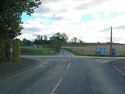
 Tibbermore crossroads | |
| Location | |
| Grid reference: | Expression error: Unexpected < operator.&y=Expression error: Unexpected < operator.&z=120 NO55235 |
| Location: | 56°23’24"N, 3°32’24"W |
| Data | |
| Population: | 157 |
| Post town: | Perth |
| Postcode: | PH1 |
| Dialling code: | 01738 |
| Local Government | |
| Council: | Perth and Kinross |
Tibbermore is a small village and parish in Perthshire situated about four miles west of the county town, Perth. The parish extends into the north-western suburbs of the city and is surrounded by Methven and Redgorton to the north, Scone to the east, Perth and Aberdalgie to the south, Forteviot to the sourth-west and Findo Gask to the west. Previously known as Tippermuir, it was the site of the Battle of Tippermuir between the Duke of Montrose and an army of Covenanters.[1]
The church building is in a poor state of repair, however, restoration is being considered.[2]
The parish has several listed buildings:
- Manse of Tibbermore
- North Blackruthven
- Low's Work Cottages
- Dupplin Icehouse
- Huntingtowerfield, S. Front Section Of Bleachwork
- Waterside Cottages, Huntingtowerfield
- West Mains of Huntingtower Farmhouse
- Ruthven House Garden Wall And Lodge
- Newhouse Farmhouse
- Newhouse Steading
- Huntingtower Castle
- Huntingtowerfield, Former Printhouse And Works Chapel With Linking Wall
- Tibbermore Parish Church Graveyard
- Low's Work Weir
- Ruthven House
- North Blackruthven Lodge
- Tibbermore Parish Church
- Tofthouses
- Grey Row, Ruthven
References
| ("Wikimedia Commons" has material about Tibbermore) |
This Perthshire article is a stub: help to improve Wikishire by building it up.
