Brixton
| Brixton | |
| Surrey | |
|---|---|
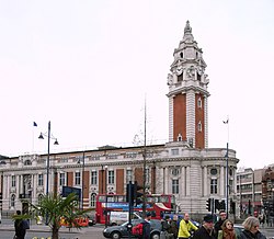
 Lambeth Town Hall | |
| Location | |
| Grid reference: | TQ315755 |
| Location: | 51°27’47"N, 0°6’22"W |
| Data | |
| Post town: | London |
| Postcode: | SW2, SW5, SW9 |
| Dialling code: | 020 |
| Local Government | |
| Council: | Lambeth |
| Parliamentary constituency: |
Streatham Vauxhall Dulwich and West Norwood |
Brixton is a town in Surrey which has become entirely swallowed within the London conurbation and wholly contiguous with its surrounding towns and neighbourhoods, those which lie at its edges being Stockwell, Clapham, Streatham, Camberwell, Tulse Hill and Herne Hill. Brixton is identified in the London Plan as one of 35 major centres in "Greater London".[1]
Brixton has given its name to the Brixton Hundred, the north-easternmost hundred of Surrey.
Brixton is predominantly residential. It has a prominent street market though and a substantial retail sector.[2] It is a multiethnic community, and around 24 percent of Brixton's population are of African and Caribbean descent,[3] and as such Brixton is considered the unofficial capital of the British Afro-Caribbean community.
References
- ↑ Mayor of London (February 2008). "London Plan (Consolidated with Alterations since 2004)". Greater London Authority. http://www.london.gov.uk/thelondonplan/docs/londonplan08.pdf.
- ↑ "Brixton Guide". All In London. 2009. http://www.allinlondon.co.uk/regions/brixton/. Retrieved 2009-04-25.
- ↑ History of Brixton

This Surrey article is a stub: help to improve Wikishire by building it up.