Brierfield
| Brierfield | |
| Lancashire | |
|---|---|
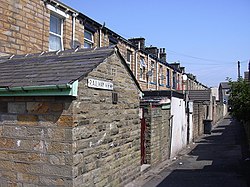
 Railway View | |
| Location | |
| Grid reference: | SD850361 |
| Location: | 53°49’16"N, 2°13’44"W |
| Data | |
| Population: | 8,199 (2001) |
| Post town: | Nelson |
| Postcode: | BB9 |
| Dialling code: | 01282 |
| Local Government | |
| Council: | Pendle |
| Parliamentary constituency: |
Pendle |
Brierfield is a small town in Lancashire 2½ miles northeast of the town Burnley, a mile southwest of the town Nelson, and half a mile northeast of Reedley. It had a population of 8,200 in 2001
History
The building of the Leeds and Liverpool Canal, the Blackburn to Addingham turnpike road and the railway line from Preston to Colne led to the town of Brierfield developing during the early 19th century. Before these new transport links were constructed, there was just a scattering of farmhouses forming part of the township of Marsden, which also covered what was to become Nelson. The construction in 1832 of the first cotton mill, just off Lob Lane (now Clitheroe Road) close to the Marsden coal pit, led to the massive growth of the settlement during the mid-19th century. New mills were quickly established along the banks of the canal and people flocked to the area to work in the cotton industry, many coming from the mining areas of the North Riding of Yorkshire as the lead seams were worked out. The cotton industry continued to be the main employer until well into the 1960s, and it was only in 2006 that BSN (formerly Smith & Nephew) finally ceased production of woven cloth at Brierfield Mills. After years of disuse, Pendle Council purchased the Mills in 2012, intending to use it as a flagship regeneration project.[1][2]
The town's war memorial features a large pewter lion roaring. The town is well known for its part in the Quaker movement. A Friends meeting house is still in use on the south-eastern boundary of the town, and the bridge over Pendle Water at the foot of the town is called Quaker Bridge.
Outside links
- St. Luke's, Brierfield Parish Church
- Virtual tours of Lancashire, including Brierfield
- Leeds Liverpool Canal in Brierfield
- St. Luke's, Organ Restoration Project
References
- ↑ Kirsty Weakley (21 March 2012). "Islamic Help sells building to local authority for £1.5m". Civil Society. http://www.civilsociety.co.uk/finance/news/content/11877/islamic_help_sells_building_to_council_for_15m?utm_source=21+March+Finance&utm_campaign=21+March+Finance&utm_medium=email. Retrieved 21 March 2012.
- ↑ "Pendle Council buys Brierfield Mill for £1.5m". BBC Lancashire. 20 March 2012. http://www.bbc.co.uk/news/uk-england-lancashire-17435080. Retrieved 21 March 2012.