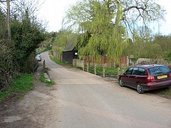
Waterend, Hertfordshire
| Waterend | |
| Hertfordshire | |
|---|---|

| |
| Location | |
| Grid reference: | TL203138 |
| Location: | 51°48’36"N, 0°15’21"W |
| Data | |
| Postcode: | AL4 |
| Local Government | |
| Council: | St Albans |
Waterend is a hamlet at a bridge over the River Lea in Hertfordshire west of Welwyn Garden City. It is on the lane between Ayot Green (northeast) and Coleman Green (southeast), a lane which marks a Roman road.