Hoseason Island: Difference between revisions
Jump to navigation
Jump to search
No edit summary |
|||
| Line 7: | Line 7: | ||
|latitude=-63.7 | |latitude=-63.7 | ||
|longitude=-61.7 | |longitude=-61.7 | ||
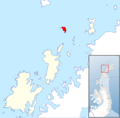
|map=Hoseason Island, Palmer Archipelago, BAT.svg | |||
|highest mount=Stopford Peak | |highest mount=Stopford Peak | ||
|height=1,624 | |height=1,624 | ||
Latest revision as of 08:45, 8 December 2022
| Hoseason Island | |
| Location | |
| Location: | 63°42’0"S, 61°42’0"W |
| Data | |
| Population: | Uninhabited |
Hoseason Island is an island six nautical miles long and three nautical miles wide, lying 20 nauticla miles west of Trinity Island in the Palmer Archipelago, in the British Antarctic Territory.
The island's name, which has appeared on charts for over 100 years, commemorates James Hoseason, first mate on the Sprightly, an Enderby Brothers sealing ship which operated in these waters in 1824–25.
References
- Gazetteer and Map of The British Antarctic Territory: Hoseason Island
