Difference between revisions of "The Glenkens"
From Wikishire
m (→References) |
m |
||
| Line 1: | Line 1: | ||
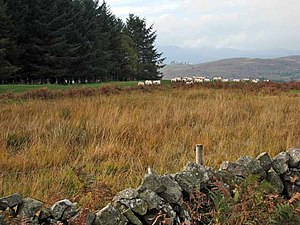
[[File:Rough grazing at Todstone in the Glenkens - geograph.org.uk - 267149.jpg|right|thumb|300px|Farmland in the Glenkens]] | [[File:Rough grazing at Todstone in the Glenkens - geograph.org.uk - 267149.jpg|right|thumb|300px|Farmland in the Glenkens]] | ||
{{county|Kirkcudbrightshire}} | {{county|Kirkcudbrightshire}} | ||
| − | '''The Glenkens''' are an area of [[Kirkcudbrightshire]], in the villages and dales about the [[Water of Ken]] | + | '''The Glenkens''' are an area of [[Kirkcudbrightshire]], in the villages and dales about the [[Water of Ken]]. |
The Glenkens is made up of the parishes of: | The Glenkens is made up of the parishes of: | ||
Latest revision as of 09:13, 19 January 2021
The Glenkens are an area of Kirkcudbrightshire, in the villages and dales about the Water of Ken.
The Glenkens is made up of the parishes of:
- Carsphairn,
- Dalry,
- Kells,
- Parton and
- Balmaclellan.[1]
The name comes from the main river here, the Water of Ken, which runs through the valley before it flowing into the River Dee and then down to the sea.
The Glenkens are found midway along the western section of the Southern Upland Way.
Outside links
References
- ↑ Visitglenkens.com - History
