Etton, Northamptonshire: Difference between revisions
Created page with "{{distinguish|Elton, Huntingdonshire}} {{Infobox town |name=Etton |county=Northamptonshire |picture=UK Etton (Cambridgeshire).jpg |picture caption=Etton village sign |os grid..." |
|||
| Line 35: | Line 35: | ||
{{Reflist}} | {{Reflist}} | ||
*East Anglian Archaeology report No.109, 2005: Archaeology and Environment of the Etton Landscape, by Charles French and Francis Pryor, Oxbow Books, {{ISBN|0-9520616-2-7}} | *East Anglian Archaeology report No.109, 2005: Archaeology and Environment of the Etton Landscape, by Charles French and Francis Pryor, Oxbow Books, {{ISBN|0-9520616-2-7}} | ||
[[Category:Soke of Peterborough]] | |||
Latest revision as of 21:31, 9 December 2019
- Not to be confused with Elton, Huntingdonshire
| Etton | |
| Northamptonshire | |
|---|---|
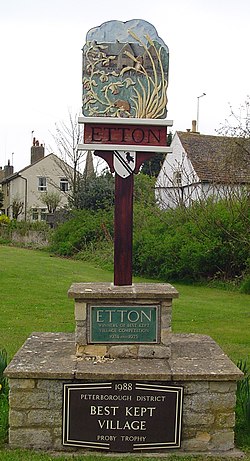
 Etton village sign | |
| Location | |
| Grid reference: | TF144065 |
| Location: | 52°38’41"N, 0°18’34"W |
| Data | |
| Population: | 158 |
| Post town: | Peterborough |
| Postcode: | PE6 |
| Dialling code: | 01733 |
| Local Government | |
| Council: | Peterborough |
| Parliamentary constituency: |
North West Cambridgeshire |
Etton is a tiny village in the Soke of Peterborough, the north-eastern part of Northamptonshire. The townscape of Peterborough suburbs finishes a little under two miles away. Etton is left within the open land of the Great Fen, equidistant between larger villages: Glinton and Helpston to the south-east and south-west respectively and Maxey and Northborough to the north-west and north-east, beyond which the River Welland marks the border of Northamptonshire with Lincolnshire.
The parish had a population of 158 persons and 58 households in 2001.
Close by is Woodcroft, a deserted mediæval village and site of Woodcroft Castle.[1]
History
A mysterious Neolithic settlement at Etton Woodgate was excavated by Francis Pryor in 1982.[2][3] He reported that the site was in two halves, with each working building on one side mirrored by an unused 'ritual' copy on the other.
Woodcroft Castle was built and moated about 1280. The west range and a corner tower survive in the present farmhouse. During the Civil War it fell to Parliamentary troops in 1648.
Peterborough Corporation Water Works opened here in 1907 "to augment the supply of water to the City of Peterborough."[4]
Outside links
| ("Wikimedia Commons" has material about Etton, Northamptonshire) |
References
- ↑ The "Deserted Villages of Northants", Allison Beresford and Hurst,1966
- ↑ "National Monuments record for Etton Woodgate". http://www.pastscape.org.uk/hob.aspx?hob_id=1217925.
- ↑ Pryor, Francis, Etton: Excavations at a Neolithic causewayed enclosure near Maxey Cambridgeshire, 1982-7, English Heritage, London (1998)
- ↑ Water works at Elton Hidden Heritage (retrieved 19 December 2009)
- East Anglian Archaeology report No.109, 2005: Archaeology and Environment of the Etton Landscape, by Charles French and Francis Pryor, Oxbow Books, ISBN 0-9520616-2-7