Moelwyn Bach: Difference between revisions
Jump to navigation
Jump to search
Created page with "{{Infobox hill |name=Moelwyn Bach |county=Merioneth |picture=Moelwyn_Bach.jpg |picture caption=Moelwyn Bach from the west |range=Snowdonia |height=2,329 ft |latitude=52.97385..." |
No edit summary |
||
| Line 4: | Line 4: | ||
|picture=Moelwyn_Bach.jpg | |picture=Moelwyn_Bach.jpg | ||
|picture caption=Moelwyn Bach from the west | |picture caption=Moelwyn Bach from the west | ||
|range= | |range=Moelwynion | ||
|height=2,329 ft | |height=2,329 ft | ||
|latitude=52.97385 | |latitude=52.97385 | ||
Latest revision as of 17:02, 1 October 2018
| Moelwyn Bach | |||
| Merionethshire | |||
|---|---|---|---|
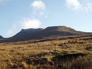
 Moelwyn Bach from the west | |||
| Range: | Moelwynion | ||
| Summit: | 2,329 ft SH660437 52°58’26"N, 3°59’49"W | ||
Moelwyn Bach is a mountain in Merionethshire, within Snowdonia, and forms part of the Moelwynion. It is connected to its parent peak Moelwyn Mawr via the Craigysgafn ridge.
It overlooks the town of Blaenau Ffestiniog and the Vale of Ffestiniog.[1]
References
- ↑ Nuttall, John & Anne (1999). The Mountains of England & Wales - Volume 1: Wales (2nd edition ed.). Milnthorpe,: Cicerone. ISBN 1-85284-304-7.
Outside links
This Mountain or hill article is a stub: help to improve Wikishire by building it up.