Pye Road: Difference between revisions
Jump to navigation
Jump to search
Created page with "right|thumb|300px|The Pye Road (A140) near Norwich File:A140 in Long Stratton looking North East.jpg|right..." |
No edit summary |
||
| Line 1: | Line 1: | ||
{{county|Norfolk}} | |||
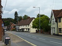
[[File:View south along the A140 - geograph.org.uk - 1196042.jpg|right|thumb|300px|The Pye Road (A140) near Norwich]] | [[File:View south along the A140 - geograph.org.uk - 1196042.jpg|right|thumb|300px|The Pye Road (A140) near Norwich]] | ||
[[File:A140 in Long Stratton looking North East.jpg|right|thumb|200px|The road at Long Stratton]] | [[File:A140 in Long Stratton looking North East.jpg|right|thumb|200px|The road at Long Stratton]] | ||
'''Pye Road''' is a Roman road running through three of the eastern counties – [[Essex]], [[Suffolk]] and [[Norfolk]] – from ''Camulodunum'' ([[Colchester]]) to ''Venta Icenorum'' ([[Caistor St Edmund]], near [[Norwich]]) | '''Pye Road''' is a Roman road running through three of the eastern counties – [[Essex]], [[Suffolk]] and [[Norfolk]] – from ''Camulodunum'' ([[Colchester]]) to ''Venta Icenorum'' ([[Caistor St Edmund]], near [[Norwich]]). | ||
==Route== | ==Route== | ||
The road runs from [[Colchester]] northwards, partly sharing a route with the A140 road.<ref>{{Cite web|url=http://www.sys.uea.ac.uk/Research/researchareas/JWMP/venta5.html|title=Ancient Landscape according to Tom Williamson}}</ref> | The road runs from [[Colchester]] northwards, partly sharing a route with the A140 road.<ref>{{Cite web|url=http://www.sys.uea.ac.uk/Research/researchareas/JWMP/venta5.html|title=Ancient Landscape according to Tom Williamson}}</ref> Between Colchester and London, the path of the former gravel road is not as certain, but it is believed to follow [[Ilford]]'s High Street, Romford Road (A118), a now unpaved route through the present [[Olympic Park]], and then the line of Whitechapel Road to [[Aldgate]] in the north-east corner of the [[City of London]].<ref>{{cite web|url=http://learninglegacy.independent.gov.uk/documents/pdfs/archaeology/ll35roman-road-aw.pdf|title=Learning Legacy: Lessons Learned from the London 2012 Games construction project|last=Chaffey|first=Gareth|publisher=Olympic Delivery Authority|date=2011|accessdate=19 February 2015}}</ref> | ||
==References== | ==References== | ||
{{reflist}} | {{reflist}} | ||
{{ | ==Outside links== | ||
*Location map: {{wmap|52.31173|1.10353|zoom=14}} | |||
[[Category:Roman roads]] | [[Category:Roman roads]] | ||
Latest revision as of 08:40, 9 May 2018


Pye Road is a Roman road running through three of the eastern counties – Essex, Suffolk and Norfolk – from Camulodunum (Colchester) to Venta Icenorum (Caistor St Edmund, near Norwich).
Route
The road runs from Colchester northwards, partly sharing a route with the A140 road.[1] Between Colchester and London, the path of the former gravel road is not as certain, but it is believed to follow Ilford's High Street, Romford Road (A118), a now unpaved route through the present Olympic Park, and then the line of Whitechapel Road to Aldgate in the north-east corner of the City of London.[2]
References
- ↑ "Ancient Landscape according to Tom Williamson". http://www.sys.uea.ac.uk/Research/researchareas/JWMP/venta5.html.
- ↑ Chaffey, Gareth (2011). "Learning Legacy: Lessons Learned from the London 2012 Games construction project". Olympic Delivery Authority. http://learninglegacy.independent.gov.uk/documents/pdfs/archaeology/ll35roman-road-aw.pdf. Retrieved 19 February 2015.
Outside links
- Location map: 52°18’42"N, 1°6’13"E