Blackhope Scar: Difference between revisions
Created page with '{{Infobox hill |name=Blackhope Scar |county 1=Midlothian |county 2=Peeblesshire |range=Moorfoot Hills |picture=Blackhope Scar - geograph.org.uk - 211784.jpg |picture caption=Blac…' |
No edit summary |
||
| Line 7: | Line 7: | ||
|picture caption=Blackhope Scar from Bowman'c Cleuch | |picture caption=Blackhope Scar from Bowman'c Cleuch | ||
|height=2,136 feet | |height=2,136 feet | ||
|os grid ref=NT315483 | |||
|latitude=55.7236 | |||
|longitude=-3.0917 | |||
}} | }} | ||
'''Blackhope Scar''' is a mountain in the [[Moorfoot Hills]] whose summit marks the border of [[Midlothian]] with [[Peeblesshire]]. It is the [[county top]] of Midlothian; the highest point in the shire. | '''Blackhope Scar''' is a mountain in the [[Moorfoot Hills]] whose summit marks the border of [[Midlothian]] with [[Peeblesshire]]. It is the [[county top]] of Midlothian; the highest point in the shire. | ||
| Line 12: | Line 15: | ||
From the slopes of Blackhope Scar rise the [[Blackhope Water]] and the [[River South Esk]], the latter beginning as a burn in the Long Cleave, a valley on the west side of the hill. | From the slopes of Blackhope Scar rise the [[Blackhope Water]] and the [[River South Esk]], the latter beginning as a burn in the Long Cleave, a valley on the west side of the hill. | ||
The hill presents a rounded summit in the Moorfoots, looking out over the bleak landscape of these hills. There is a large windfarm covering the summits to the | The hill presents a rounded summit in the Moorfoots, looking out over the bleak landscape of these hills. There is a large windfarm covering the summits to the south-west. To the north-north-west, the ruin of Hirendean Castle may be seen. | ||
==Ascents== | ==Ascents== | ||
The hill may be climbed: | The hill may be climbed: | ||
*From the | *From the north-west, over tracks beginning at [[Moorfoot]] and up the Long Cleave | ||
*From the south, from the {{getmap|NN291528|Gladhouse Reservoir}} | *From the south, from the {{getmap|NN291528|Gladhouse Reservoir}} | ||
*From the B7007 road to the NW at Windy Slack. | *From the B7007 road to the NW at Windy Slack. | ||
| Line 24: | Line 27: | ||
===Hirendean Castle=== | ===Hirendean Castle=== | ||
Hirendean Castle is a ruined 16th century peel tower found by the track a few miles below Blackhope Scar in the dale of the River South Esk, north- | Hirendean Castle is a ruined 16th century peel tower found by the track a few miles below Blackhope Scar in the dale of the River South Esk, north-north-west of the hill summit. A walker coming up or down that way may come across it as a ruin with stories to tell in its stones. | ||
Originally it stood foursquare 40 feet by 23 feet, but now only the south wall and the west gable still stand to any height, although the north wall can be identified amongst rubble. | Originally it stood foursquare 40 feet by 23 feet, but now only the south wall and the west gable still stand to any height, although the north wall can be identified amongst rubble. | ||
Latest revision as of 10:12, 10 March 2018
| Blackhope Scar | |||
| Midlothian, Peeblesshire | |||
|---|---|---|---|
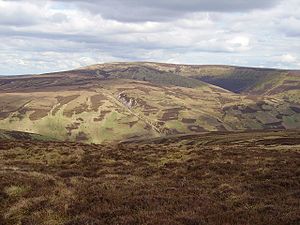
 Blackhope Scar from Bowman'c Cleuch | |||
| Range: | Moorfoot Hills | ||
| Summit: | 2,136 feet NT315483 55°43’25"N, 3°5’30"W | ||
Blackhope Scar is a mountain in the Moorfoot Hills whose summit marks the border of Midlothian with Peeblesshire. It is the county top of Midlothian; the highest point in the shire.
From the slopes of Blackhope Scar rise the Blackhope Water and the River South Esk, the latter beginning as a burn in the Long Cleave, a valley on the west side of the hill.
The hill presents a rounded summit in the Moorfoots, looking out over the bleak landscape of these hills. There is a large windfarm covering the summits to the south-west. To the north-north-west, the ruin of Hirendean Castle may be seen.
Ascents
The hill may be climbed:
- From the north-west, over tracks beginning at Moorfoot and up the Long Cleave
- From the south, from the Gladhouse Reservoir
- From the B7007 road to the NW at Windy Slack.
Above the farmland of the lower slopes, Blackhope Scar rises into a blanket of high and largely featureless moorland. After the track peters out, the tussocks and boggy ground are hard going, but the summit when reached presents a broad view over the Moorfoot Hills.
Hirendean Castle
Hirendean Castle is a ruined 16th century peel tower found by the track a few miles below Blackhope Scar in the dale of the River South Esk, north-north-west of the hill summit. A walker coming up or down that way may come across it as a ruin with stories to tell in its stones.
Originally it stood foursquare 40 feet by 23 feet, but now only the south wall and the west gable still stand to any height, although the north wall can be identified amongst rubble.
The Kipps
The Kipps are a group of heights between Blackhope Scar and Hirendean Castle, easily reached from either. They are off the track and some walkers consider a climb up the Kipps the better route to the top of Blackhope Scar, bringing one up to height at a better stage and revealing the beautiful landscape that is hidden fro view on the track in the dale.