Template:Infobox county: Difference between revisions
Jump to navigation
Jump to search
Moving picture up |
include an article link under the image of the flag |
||
| Line 9: | Line 9: | ||
{{#if: {{#var:flag<includeonly>|</includeonly>}} | | {{#if: {{#var:flag<includeonly>|</includeonly>}} | | ||
! colspan=2 style="background: white; text-align: center; font-size: 85%;" {{!}} [[File:{{#var:flag}}|150px|Flag of {{{name<includeonly>|</includeonly>}}}]] }} | ! colspan=2 style="background: white; text-align: center; font-size: 85%;" {{!}} [[File:{{#var:flag}}|150px|Flag of {{{name<includeonly>|</includeonly>}}}]] }} | ||
|- | |||
{{#if: {{#var:flag<includeonly>|</includeonly>}} | | |||
! colspan=2 style="background: white; text-align: center; font-size: 85%;" {{!}} [[Flag of {{{name<includeonly>|</includeonly>}}}|Flag]] }} | |||
|- class="note" | |- class="note" | ||
{{#if: {{{motto<includeonly>|</includeonly>}}} | | {{#if: {{{motto<includeonly>|</includeonly>}}} | | ||
Revision as of 15:33, 27 October 2017
| {{{name}}} error: name not on list | |
| [[File:{{{picture}}}|240px]] {{{picture caption}}} | |
|---|---|
| {{{motto}}} | |
| [[File:{{{map image}}}|170px|{{{name}}}]] | |
| [Interactive map] | |
| County of: | {{{county of}}} |
| Abbreviation: | {{{abbr}}} |
| Area: | {{{area}}} |
| Population: | {{{population}}} |
| County seat: | {{{county town}}} |
| Biggest town: | {{{biggest town}}} |
Usage
Blank template
{{Infobox county
| name=
| welsh=
| gaelic=
| irish=
| scots=
| cornish=
| map image=
| flag=
| motto=
| picture=
| picture caption
| province=
| area=
| population=
| county town=
| biggest town=
}}
Examples
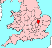
Example 1: Huntingdonshire
| Name United Kingdom | |

| |
|---|---|

| |
| Flag | |
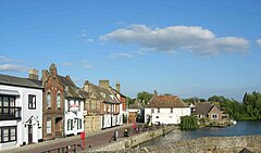
 St Ives | |
| Area: | 359 square miles |
| County town: | Huntingdon |
| Biggest town: | St Neots |
| County flower: | Water-violet [1] |
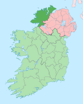
Example 2: County Donegal
| Name Irish: Contae Dhún na nGall Republic of Ireland | |

| |
|---|---|
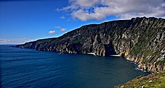
 Slieve League cliffs | |
| Province: | Ulster |
| Area: | 1,869 square miles |
| Population: | 147,264 |
| County seat: | Lifford |