Difference between revisions of "Elphin, Sutherland"
(Created page with "{{Infobox town |name= Elphin |gaelic=Ailbhinn |county=Sutherland |picture=Elphin - geograph.org.uk - 956679.jpg |os grid ref=NC212111 |latitude=58.053231 |longitude=-5.030673|...") |
(No difference)
|
Latest revision as of 18:13, 23 June 2017
| Elphin Gaelic: Ailbhinn | |
| Sutherland | |
|---|---|

| |
| Location | |
| Grid reference: | NC212111 |
| Location: | 58°3’12"N, 5°1’50"W |
| Data | |
| Post town: | Ullapool |
| Postcode: | IV27 |
| Local Government | |
| Council: | Highland |
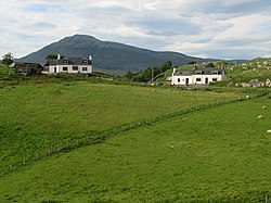
Elphin is a crofting township in the parish of Assynt in Sutherland, adjacent to the border with Cromartyshire. It lies about 15 miles north of Ullapool in the latter county. The village contains a telephone box, a post box, a tearoom, a Scottish Mountaineering Club Hut, Grampian Speleological Group Hut, a small caravan site and many self-catering options. Assynt Primary School closed in 2001, and the building is now a community hall operated by Elphin Ledmore and Knockan Community Association Limited. The name is from the Gaelic Ailbhinn, which possibly derives from a combination of Norse and Gaelic, Fjell (cliff or rock) + Fionn (bright).
Knockan Crag is about two miles south of Elphin and Loch Veyatie is about half a mile to the north-west.
Notable People
- Rev. Prof. G.. M. Collins DD, twice Moderator of the General Assembly of the Free Church of Scotland was raised in Elphin.