Harecleugh Forest: Difference between revisions
Jump to navigation
Jump to search
Created page with "right|thumb|300px|The thick wall of the forest edge {{county|Berwickshire}} '''Harecleugh Forest''' is a little woodl..." |
|||
| Line 12: | Line 12: | ||
*Streetmap: {{map|NT616535}} | *Streetmap: {{map|NT616535}} | ||
[[Category:Forests of Berwickshire]] | [[Category:Forests and woodlands of Berwickshire]] | ||
Latest revision as of 22:24, 14 November 2016

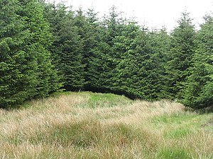
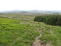
Harecleugh Forest is a little woodland made of a dense sitka spruce plantation on the southern slopes of the Lammermuir Hills in Berwickshire. It is two miles north of Westruther, with the tiny hamlet of Flass near its southern edge.
The highest point in the forest is the summit of Flass Hill, at 1,243 feet.
The Southern Upland Way does not cross the forest fence but runs within a few yards of the northern edge of the wood as it reaches the summit of Twin Law.

Location
- Location map: 55°46’24"N, 2°36’49"W
- Streetmap: NT616535