Difference between revisions of "Tregurnow"
From Wikishire
(Created page with "{{Infobox town |name= Tregurnow |county=Cornwall |picture=Tregurnow Cliff - geograph.org.uk - 781877.jpg |picture caption=Tregurnow Cliff |os grid ref=SW442241 |latitude=50.06...") |
(No difference)
|
Latest revision as of 12:37, 10 October 2016
| Tregurnow | |
| Cornwall | |
|---|---|
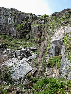
 Tregurnow Cliff | |
| Location | |
| Grid reference: | SW442241 |
| Location: | 50°3’44"N, 5°34’28"W |
| Data | |
| Post town: | Penzance |
| Postcode: | TR19 |
| Local Government | |
| Council: | Cornwall |
Tregurnow is a hamlet in St Buryan parish on the Penwith peninsula in the far west of Cornwall.
At Tregurnow farm is an interesting Celtic cross from the mediæval period similar to ones found on the Isle of Man.
Tregurnow also gives its name to the site of a stone circle that previously stood in the area at SW4381824523. The cliffs above Lamorna Cove bear the name too.