Difference between revisions of "Mote of Mark"
(Created page with '{{Infobox NT |name=Mote of Mark |county=Kirkcudbrightshire |os grid ref=NX845540 |picture=Top of the Mote of Mark - geograph.org.uk - 259782.jpg |picture caption=The top of the M…') |
m (clean up, typos fixed: a 5th century → a 5th-century) |
||
| Line 7: | Line 7: | ||
|website={{NT link|Rockcliffe}} | |website={{NT link|Rockcliffe}} | ||
}} | }} | ||
| − | The '''Mote of Mark''' is a 5th century hill fort in [[Kirkcudbrightshire]] which stands on the shores of the [[Solway Firth]]. Beside it is the village of [[Rockcliffe, Kirkcudbrightshire|Rockcliffe]]. | + | The '''Mote of Mark''' is a 5th-century hill fort in [[Kirkcudbrightshire]] which stands on the shores of the [[Solway Firth]]. Beside it is the village of [[Rockcliffe, Kirkcudbrightshire|Rockcliffe]]. |
The fort overlooks the Urr estuary and in its time would have guarded the approach. Of the fort only ruins remain but these show that it would once have been the seat of a powerful chieftain of the Dark Ages, possibly ruling in the Kingdom of [[Rheged]]. | The fort overlooks the Urr estuary and in its time would have guarded the approach. Of the fort only ruins remain but these show that it would once have been the seat of a powerful chieftain of the Dark Ages, possibly ruling in the Kingdom of [[Rheged]]. | ||
Latest revision as of 20:04, 1 February 2016
| Mote of Mark | |
| National Trust for Scotland | |
|---|---|
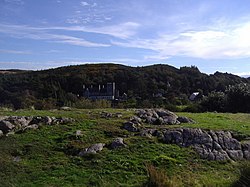
 The top of the Mote of Mark | |
| Grid reference: | NX845540 |
| Information | |
| Website: | Rockcliffe |
The Mote of Mark is a 5th-century hill fort in Kirkcudbrightshire which stands on the shores of the Solway Firth. Beside it is the village of Rockcliffe.
The fort overlooks the Urr estuary and in its time would have guarded the approach. Of the fort only ruins remain but these show that it would once have been the seat of a powerful chieftain of the Dark Ages, possibly ruling in the Kingdom of Rheged.
The site was occupied during the 6th century and appears to have been destroyed by fire in the 7th century since when it has been abandoned.
Appearance
The hill is generally shallow of slope but more prominent at the top. The top of the hill was enclosed by a massive stone and timber rampart within which once stood a timber hall surrounded by a huddle of workshops and stables.
Archaeological finds from the excavations include glass beads and wine jars from central Gaul and glassware from Germany, evidence of an extensive trading network.
Outside links
- Mote of Mark – Dumfries Museum