Carn Ruigh Thuim: Difference between revisions
Jump to navigation
Jump to search
Created page with "{{Infobox hill |name=Carn Ruigh Thuim |county=Morayshire |picture=South of Carn Ruigh Thuim en route it Aittendow. - geograph.org.uk - 547914.jpg |picture caption=South of Car..." |
mNo edit summary |
||
| Line 2: | Line 2: | ||
|name=Carn Ruigh Thuim | |name=Carn Ruigh Thuim | ||
|county=Morayshire | |county=Morayshire | ||
|range=Dava Moor | |||
|picture=South of Carn Ruigh Thuim en route it Aittendow. - geograph.org.uk - 547914.jpg | |picture=South of Carn Ruigh Thuim en route it Aittendow. - geograph.org.uk - 547914.jpg | ||
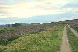
|picture caption=South of Carn Ruigh Thuim | |picture caption=South of Carn Ruigh Thuim | ||
Revision as of 15:00, 10 May 2015
| Carn Ruigh Thuim | |||
| Morayshire | |||
|---|---|---|---|
 South of Carn Ruigh Thuim | |||
| Range: | Dava Moor | ||
| Summit: | 1,325 feet NJ025395 57°26’7"N, 3°37’33"W | ||
Carn Ruigh Thuim is a mountain of 1,325 feet in Morayshire. It forms a pair with Carn Biorach beside it (1,371 feet).
The twin hills stand away from the high border ridge with Banffshire on which the county's highest peaks are found, and may be found in the hills north of Strathspey that run down to Forres and the coastal plain: Carn Ruigh Thuim and Carn Biorach are to the east of the Dorback Burn, and south of the rather prominent hill, the Knock of Braemoray.
This Mountain or hill article is a stub: help to improve Wikishire by building it up.