Dalmahoy Hill: Difference between revisions
Created page with "{{Infobox hill |name=Dalmahoy Hill |county=Midlothian |picture=Dalmahoy Hill - geograph.org.uk - 887639.jpg |picture caption=Dalmahoy Hill |os grid ref=NT135668 |latitude=55.8..." |
mNo edit summary |
||
| Line 9: | Line 9: | ||
|height=817 feet | |height=817 feet | ||
}} | }} | ||
'''Dalmahoy Hill''' or '''Dalmahoy Craig''' is a modest hill in the west of [[Midlothian]], between [[Balerno]] and [[Kirknewton]]. It is a craggy, uneven hill on which are found the remains of an Iron Age hill fort. A second is on the adjacent hill, [[Kaimes Hill]]. | '''Dalmahoy Hill''' or '''Dalmahoy Craig''' is a modest hill in the west of [[Midlothian]], between [[Balerno]] and [[Kirknewton, Midlothian|Kirknewton]]. It is a craggy, uneven hill on which are found the remains of an Iron Age hill fort. A second is on the adjacent hill, [[Kaimes Hill]]. | ||
Kaimes and Dalmahoy Hills are an isolated pair of hills, reaching 820 feet and 817 feet above sea level respectively. Their position would have allowed the forts to command a broad view across the west of the Lothians. | Kaimes and Dalmahoy Hills are an isolated pair of hills, reaching 820 feet and 817 feet above sea level respectively. Their position would have allowed the forts to command a broad view across the west of the Lothians. | ||
Latest revision as of 05:47, 6 May 2015
| Dalmahoy Hill | |
| Midlothian | |
|---|---|
 Dalmahoy Hill | |
| Summit: | 817 feet NT135668 55°53’14"N, 3°23’2"W |
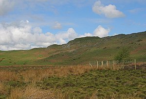
Dalmahoy Hill or Dalmahoy Craig is a modest hill in the west of Midlothian, between Balerno and Kirknewton. It is a craggy, uneven hill on which are found the remains of an Iron Age hill fort. A second is on the adjacent hill, Kaimes Hill.
Kaimes and Dalmahoy Hills are an isolated pair of hills, reaching 820 feet and 817 feet above sea level respectively. Their position would have allowed the forts to command a broad view across the west of the Lothians.
Hill fort
Dating the hill fort has proven uncertain. The works appear to be of two distinct ages: pre-Roman and possibly post-Roman.
In the early stage, the hill was enclosed by a system of stone walls which defended an area measuring 1,200 feet by 400 feet, its northwest flank defended by the hill's precipitous face. The second phase was an oval enclosure on the very summit of the hill, which measures 140 feet by 85 feet.
The date of the second phase cannot be determined but the RCAHMS reckons that a post-Roman date is possible as it belongs to a class of such monuments which are almost always found to overlie pre-Roman forts.
Within part the fort are the remains of a hut circle, with an internal diameter of 19 feet. There is an inner facing of stones set on edge. The entrance has been from the east.