Megget Water: Difference between revisions
Jump to navigation
Jump to search
Created page with "{{hatnote:Not to be confused with the Meggat Water in Dumfriesshire}} File:Megget Water and Megget Reservoir - geograph.org.uk - 182452.jpg|thumb|right|300px|The Megget ..." |
mNo edit summary |
||
| Line 1: | Line 1: | ||
{{hatnote | {{hatnote|Not to be confused with the [[Meggat Water]] in Dumfriesshire}} | ||
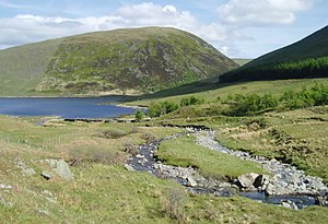
[[File:Megget Water and Megget Reservoir - geograph.org.uk - 182452.jpg|thumb|right|300px|The Megget Reservoir and Megget Water, Peeblesshire]] | [[File:Megget Water and Megget Reservoir - geograph.org.uk - 182452.jpg|thumb|right|300px|The Megget Reservoir and Megget Water, Peeblesshire]] | ||
The '''Megget Water''' is a river in [[Peeblesshire]]. | The '''Megget Water''' is a river in [[Peeblesshire]]. | ||
Revision as of 17:45, 6 March 2015
Not to be confused with the Meggat Water in Dumfriesshire

The Megget Water is a river in Peeblesshire.
The Water rises on the southern slopes of Broad Law, the county’s highest point, and from here ist takes its course south to the Magget Stone and then east. Past Meggett Head it enters the Megget Reservoir and having flowed out form the dam it heads east again and empties at last into St Mary's Loch, on the county’s border with Selkirkshire.
Places in the vicinity include Cappercleuch, Craigierig, Cramalt Tower, the Glengaber Burn, Meggethead Farm.
The area is of geological and archaeological interest, through stone artifacts at Henderland in the parish of Yarrow (now in Wilton Lodge Museum, Hawick), and discoveries of gold.
Outside links
- RCAHMS record of Henderland, Megget Water
- CANMORE/RCAHMS record of Boar Cleuch Flow, Megget Water
- CANMORE/RCAHMS record of Glengaber Burn, Gold Workings
- Cramalt tower:historical survey and excavations 1977-9
- Ancient Stones: The Megget Stone, near Cappercleuch
- Vision of Britain, Gazetteer entries for Peebles Shire
References
- NMS (1992d), 'Megget Water (Yarrow parish):cup-marked stone', Discovery Excav Scot, page 7
- Scottish Journal of Geology (The Geological Society}: R.J.Chapman, R.C.Leake, J.D,Floyd: Regional variation in gold mineralization in the vicinity of the Glengaber Burn, Scottish Borders
- Proc Soc Antiq Scot, III, 1981, 401-429, Cramalt Tower:historical survey and excavations 1977-9, Alastair M T Maxwell-Irving