Lough Ree: Difference between revisions
| Line 41: | Line 41: | ||
[[Category:Loughs of Westmeath]] | [[Category:Loughs of Westmeath]] | ||
[[Category:Loughs of County Roscommon]] | [[Category:Loughs of County Roscommon]] | ||
[[Category:Loughs on the River Shannon]] | |||
[[Category:Important Bird Areas of the Republic of Ireland]] | [[Category:Important Bird Areas of the Republic of Ireland]] | ||
Latest revision as of 12:23, 1 October 2014


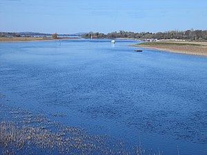
Lough Ree is a lake in the midlands of Ireland, the second of the three major lakes on the River Shannon. Its name is from the Irish language in which it is called Loch Rí or Loch Ríbh, meaning "Lake of the King".
Lough Ree at 41 square miles is the largest lake on the Shannon after Lough Derg. The other two major lakes are Lough Allen to the north, and Lough Derg to the south, there are also several minor lakes along the length of the river. The lake serves as a border between the counties of Longford and Westmeath (both in the province of Leinster) on the eastern side and County Roscommon in the province of Connaught on the western side.
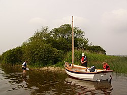
The lake is popular for fishing and boating. The lake supports a small commercial eel fishery and is locally famous for its eels on wheels truck. The town of Athlone is situated at the southern end of the lake, and has a harbour for boats going out on the lake. The small town of Lanesboro is at the northern end of the lake.
The island of Inchcleraun (Inis Cloithreann) in the northern part of the lake is the site of a monastery founded in the early Christian era and contains the remains of several ancient churches. In Irish legends, it was on this island that Queen Maeve ('Medb') was killed. The Viking king Turgesius controlled a ringfort on the shores until his death by drowning in Lough Owel.
Families lived on some of the islands in Lough Ree up until the 1950s, when they were rehoused ashore. Like several other Irish loughs, Lough Ree has been the scene of claimed sightings of a lake monster over the years.[1]
The Geographical centre of Ireland is in the townland of Carnagh East, Co. Roscommon on the western shore of Lough Ree, opposite the Cribby Islands[2] Also Hodson pillar which is located on an island on the lake is said to be the most central point in Ireland.
Annalistic references
From the Annals of Inisfallen:
- AI907.1 Kl. The plundering of Lough Rí by the men of Mumu as far as Mairg Laigen and Mag Léna, as a result of which Mael Craíbe son of Cathalán, king of Cenél Fiachrach,and many others were slain.
- AI922.2 Tomrair son of Elgi, a Jarl of the foreigners, on Luimnech (the Lower Shannon), and he proceeded and plundered Inis Celtra and Muicinis, and burned Cluain Moccu Nóis; and he went on Loch Rí and plundered all its islands, and he ravaged Mide.
From the Annals of the Four Masters:
- M934.6.Amhlaibh Ceannchairech, with the foreigners, came from Loch Eirne across Breifne to Loch Ribh. On the night of Great Christmas they reached the Sinainn, and they remained seven months there; and Magh-Aei was spoiled and plundered by them.
From the Annals of Inisfallen
- AI988.2 A fleet, viz. 300 boats, [was put] on Loch Rí by Brian [Brian Boru], and they harried Mide and went to Uisnech. And twenty five boats of these went into Connachta, and a great slaughter of their crews was inflicted there, including Dúnlang, king of Raithlenn, Niall Ua hEirc, Dúngalach Ua Loingsig, and many others. And by them was slain Muirgius son of Conchobar, royal heir of Connachta.
- AI1016.3 A great hosting by Brian's son to Loch Rí, and he plundered Inis Clothrann (Inchcleraun) and Inis Bó Finne, brought away the boats of Mael Sechnaill and Leth Cuinn, and took the hostages of Mumu from Cnámhchaill westwards.
References
53°30′N 7°58′W / 53.5°N 7.967°WCoordinates: 53°30′N 7°58′W / 53.5°N 7.967°W