Broxburn, East Lothian: Difference between revisions
Jump to navigation
Jump to search
Created page with '{{Infobox town |name=Broxburn |county=East Lothian |picture=Brands Mill, Broxburn - geograph.org.uk - 301900.jpg |picture caption=Brands Mill, Broxburn |os grid ref=NT692773 |lat…' |
|||
| Line 13: | Line 13: | ||
==Outside links== | ==Outside links== | ||
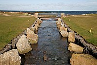
[[File:The Brox Burn - geograph.org.uk - 1201747.jpg|left|200px|The Brox Burn]] | [[File:The Brox Burn - geograph.org.uk - 1201747.jpg|thumb|left|200px|The Brox Burn]] | ||
*[http://www.scottish-places.info/towns/townfirst2819.html Broxburn] | *[http://www.scottish-places.info/towns/townfirst2819.html Broxburn] | ||
Latest revision as of 06:42, 6 August 2014
| Broxburn | |
| East Lothian | |
|---|---|
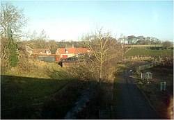
 Brands Mill, Broxburn | |
| Location | |
| Grid reference: | NT692773 |
| Location: | 55°59’16"N, 2°29’37"W |
| Data | |
| Local Government | |
Broxburn is a hamlet in East Lothian a mile and a half southeast of Dunbar, consisting of a handful of scattered houses which today largely serve the nearby Broxmouth estate. It is named after the creek upon which it stands, the Brox Burn.
On the Brox Burn is Brand's Mill, dating from the Middle Ages. The Battle of Dunbar, which sealed Cromwell's dominance of Scotland, was fought on 3 September 1650 on the foothills directly south, halfway between Brand's Mill and the hamlet of Little Pinkerton.
Outside links
