Beinn Mhòr, South Uist: Difference between revisions
Jump to navigation
Jump to search
Created page with "{{Infobox hill |name=Beinn Mhòr |county=Inverness |island=South Uist |picture=South_Uist_Beinn_Mhor.jpg |picture caption=Beinn Mhòr |os grid ref=NF809310 |latitude=57.25845..." |
No edit summary |
||
| Line 11: | Line 11: | ||
|height_m=620 m | |height_m=620 m | ||
}} | }} | ||
'''Beinn Mhòr''' is a mountain on the island of [[South Uist]] in the [[Outer Hebrides]], and within [[Inverness-shire]]. It is the highest point on the island, | '''Beinn Mhòr''' is a mountain on the island of [[South Uist]] in the [[Outer Hebrides]], and within [[Inverness-shire]]. It is the highest point on the island, reaching a summit at 2,030 feet above sea level. | ||
The name ''Beinn Mhòr'' is Gaelic for "big mountain". An alternative name for the mountain is 'Geitaval'. | The name ''Beinn Mhòr'' is Gaelic for "big mountain". An alternative name for the mountain is 'Geitaval'. | ||
Latest revision as of 23:30, 30 June 2017
| Beinn Mhòr | |||
| Inverness-shire | |||
|---|---|---|---|
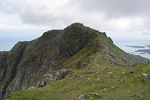
 Beinn Mhòr | |||
| South Uist | |||
| Summit: | 2,030 feet NF809310 57°15’30"N, 7°17’42"W | ||
Beinn Mhòr is a mountain on the island of South Uist in the Outer Hebrides, and within Inverness-shire. It is the highest point on the island, reaching a summit at 2,030 feet above sea level.
The name Beinn Mhòr is Gaelic for "big mountain". An alternative name for the mountain is 'Geitaval'.
Outside links
| ("Wikimedia Commons" has material about Beinn Mhòr, South Uist) |
