Caldbeck Fells: Difference between revisions
No edit summary |
No edit summary |
||
| Line 1: | Line 1: | ||
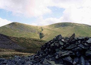
[[File:Great Sca Fell from Meal Fell.jpg|right|thumb|300px|Great Sca Fell from Meal Fell]] | [[File:Great Sca Fell from Meal Fell.jpg|right|thumb|300px|Great Sca Fell from Meal Fell]] | ||
{{county|Cumberland}} | {{county|Cumberland}} | ||
The '''Caldbeck Fells''' are the northenmost extent of the mountains of the [[Lake District]], in an area known as on 'the Back O'Skiddaw' as they are, from one perspective, behind that great fell massif, [[Skiddaw]], which rises to 3,054 feet to the south-west. The [[ | The '''Caldbeck Fells''' are the northenmost extent of the mountains of the [[Lake District]], in an area known as on 'the Back O'Skiddaw' as they are, from one perspective, behind that great fell massif, [[Skiddaw]], which rises to 3,054 feet to the south-west. The [[Uldale Fells]] are the western extent of the Caldbeck Fells. | ||
North of this group, the land descends to the dale of the Cald Beck and of the [[River Caldew]], which it feeds. [[Caldbeck]] village stands to the north of the fells, at a union of streams creating the Cald Beck. | North of this group, the land descends to the dale of the Cald Beck and of the [[River Caldew]], which it feeds. [[Caldbeck]] village stands to the north of the fells, at a union of streams creating the Cald Beck. | ||
| Line 19: | Line 19: | ||
**[[Great Sca Fell]] (2,136 feet) | **[[Great Sca Fell]] (2,136 feet) | ||
**[[Longlands Fell]] (1,585 feet) | **[[Longlands Fell]] (1,585 feet) | ||
**[[ | **[[Meal Fell]] (1,804 feet) | ||
==Mining== | ==Mining== | ||
Latest revision as of 20:49, 29 June 2017

The Caldbeck Fells are the northenmost extent of the mountains of the Lake District, in an area known as on 'the Back O'Skiddaw' as they are, from one perspective, behind that great fell massif, Skiddaw, which rises to 3,054 feet to the south-west. The Uldale Fells are the western extent of the Caldbeck Fells.
North of this group, the land descends to the dale of the Cald Beck and of the River Caldew, which it feeds. Caldbeck village stands to the north of the fells, at a union of streams creating the Cald Beck.
This part of Cumberland is far from the heart of the tourist hotspots of the Lake District: there are no villages amongst the fells nor shining waters amongst nor at the edge of them, nor forests on the slopes, which leaves the Caldbeck Fells accessible but quiet, and perhaps underappreciated.
The hills have not always been quiet though: below the sweeping turf, the fells are rich in minerals, which have been mined for centuries.
The main tops of the Caldbeck Fells are:
- High Pike (Caldbeck) (2,159 feet)
- Carrock Fell (2,165 feet)
- Knott (2,329 feet)
- Brae Fell (1,923 feet)
- The Udale Fells:
- Great Cockup (1,726 feet)
- Great Sca Fell (2,136 feet)
- Longlands Fell (1,585 feet)
- Meal Fell (1,804 feet)
Mining
The Caldbeck Fells have a complex geology, which produces a wide variety of rocks and minerals. The fells yield copper, lead, zinc, iron and tungsten minerals. They have caledonite, campylite, hemimorphite, linarite, and plumbogummite. Some 160 or so different minerals have been identified from the Caldbeck Fells.[1]
Mines have been sunk in the Caldbeck Fells for centuries and the hills are stung with ancient miners' tracks. The mines have yielded both metals and baryte minerals, for the latter of which mining started in earnest in the 19th century. The Driggith Mine had produced copper and lead but was reopened for barytes in 1926, while the East Potts Gill Mine began mining for barytes in 1942, when the chemicals extracted from these minerals became essential war material, used in munitions. Some 150,000 tons of dressed barytes were produced from the mines of Caldbeck until operations ceased in 1966 with the closure of the Sandbeds mines.[2]
Outside links
| ("Wikimedia Commons" has material about Caldbeck Fells) |
