Bradford Moor: Difference between revisions
Jump to navigation
Jump to search
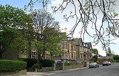
Created page with "right|thumb|240px|First Avenue, Bradford Moor {{county|Yorkshire}} '''Bradford Moor''' is a suburb of Br..." |
No edit summary |
||
| Line 8: | Line 8: | ||
==Recreation== | ==Recreation== | ||
The Myra Shay Recreation Ground on Barkerend Road is a [[Queen Elizabeth II Playing Field]]. | The Myra Shay Recreation Ground on Barkerend Road is a [[Queen Elizabeth II Field|Queen Elizabeth II Playing Field]]. | ||
==Outside links | ==Outside links== | ||
*Location map: {{wmap|53.797| -1.704}} | *Location map: {{wmap|53.797|-1.704}} | ||
[[Category:Towns and villages in the West Riding of Yorkshire]] | [[Category:Towns and villages in the West Riding of Yorkshire]] | ||
Latest revision as of 20:05, 13 May 2016

Bradford Moor is a suburb of Bradford built up on what was once the moorland to the east of the town.
The main road through the middle, the B6381, is the direct route between the centres of Bradford and Leeds, though now a bypass roads loops south.
The moor once spread from near the centre of Bradford, where the suburb now stands. This moorland was urbanised relatively late in the city's history, but sundered from its wild roots, it now bears an inner-city character.
Recreation
The Myra Shay Recreation Ground on Barkerend Road is a Queen Elizabeth II Playing Field.
Outside links
- Location map: 53°47’49"N, 1°42’14"W