Cape Pembroke: Difference between revisions
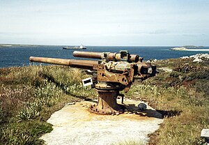
Created page with "right|thumb|300px|4" gun emplacement on Cape Pembroke {{county|Falkland Islands}} '''Cape Pembroke''' is the easternmost point of..." |
|||
| Line 18: | Line 18: | ||
{{reflist}} | {{reflist}} | ||
[[Category:Headlands of | [[Category:Headlands of East Falkland|Pembroke, Cape]] | ||
Latest revision as of 21:28, 18 May 2018

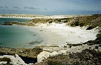
Cape Pembroke is the easternmost point of the Falkland Islands, and is on East Falkland.
The cape projects eastwards into the Atlantic Ocean, forming the southern headland of the mouth of Port William, the large bay which leads in to the enclosed water of Stanley Harbour.
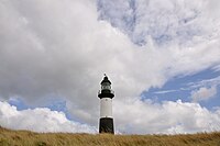
There is an automated lighthouse here, Cape Pembroke Lighthouse, built in 1855, and rebuilt in 1906, and restored in the 1990s. Previously, the nearby Billy Rock offshore had claimed fifteen ships, and there were unlit markers here. The lighthouse itself, is now a listed building.[1]
Farm and James Smith
In the late nineteenth century, Cape Pembroke peninsula was a small farm, which the islands' government leased to James Smith of Stanley. There were few such small farms in the islands and James Smith was ardent in his support of agrarian reform.


Outside links
- Location map: 51°40’56"S, 57°43’8"W
Refernces
- ↑ "Falkland Islands Information Web Portal". Buildings and Structures in the Falkland Islands designated as being of Architectural or Historic Interest. http://www.falklands.info/background/listedb.html. Retrieved 2008-07-08.