Rabot Island: Difference between revisions
Created page with "{{Infobox island |name=Rabot Island |territory=BAT |picture= |picture caption= |latitude=-65.9 |longitude=-65.98 |group=Biscoe Islands |highest height= |population=Uninhabited..." |
No edit summary |
||
| Line 4: | Line 4: | ||
|picture= | |picture= | ||
|picture caption= | |picture caption= | ||
|latitude=-65. | |latitude=-65.9034 | ||
|longitude=-65. | |longitude=-65.9548 | ||
|map=Rabot Island - Biscoe Islands, BAT.svg | |||
|group=Biscoe Islands | |group=Biscoe Islands | ||
| | |area= | ||
| | |summit= | ||
}} | }} | ||
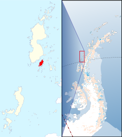
'''Rabot Island''' is | '''Rabot Island''' is one of the [[Biscoe Islands]], which lie off the coast of [[Graham Land]] in the [[British Antarctic Territory]]. The island is a mile south of [[Renaud Island]], separated from it by the Rodman Passage. | ||
This island was roughly charted by the French Antarctic Expedition, 1903-05, and named IÎle Rabot after Charles Rabot (1856-1944), French geographer and glaciologist, and Editor of ''La Géographie'' of the Geographical Society of Paris: Rabot assisted the French Antarctic Expedition, 1903-05, and who was Secretary of the Comité de Patronage and a member of the Commission des Traveaux Scientifiques of the French Antarctic Expedition, 1908-10, and represented the Ministre de l'Instruction Publique at the reception for that expedition on its return to France. | |||
The island was photographed from the air by the Falkland Islands and Dependencies Aerial Survey Expedition, 1956-57. | |||
==Outside links== | ==Outside links== | ||
* | *{{basgaz}} | ||
Latest revision as of 23:26, 25 February 2022
| Rabot Island | |
| Location | |
| Location: | 65°54’12"S, 65°57’17"W |
| Data | |
Rabot Island is one of the Biscoe Islands, which lie off the coast of Graham Land in the British Antarctic Territory. The island is a mile south of Renaud Island, separated from it by the Rodman Passage.
This island was roughly charted by the French Antarctic Expedition, 1903-05, and named IÎle Rabot after Charles Rabot (1856-1944), French geographer and glaciologist, and Editor of La Géographie of the Geographical Society of Paris: Rabot assisted the French Antarctic Expedition, 1903-05, and who was Secretary of the Comité de Patronage and a member of the Commission des Traveaux Scientifiques of the French Antarctic Expedition, 1908-10, and represented the Ministre de l'Instruction Publique at the reception for that expedition on its return to France.
The island was photographed from the air by the Falkland Islands and Dependencies Aerial Survey Expedition, 1956-57.
Outside links
- Gazetteer and Map of The British Antarctic Territory: Rabot Island
