Scaraben: Difference between revisions
Jump to navigation
Jump to search
Created page with "{{Infobox hill |name=Scaraben |county=Caithness |picture=Scaraben Summit - geograph.org.uk - 483802.jpg |picture caption=The summit of Scaraben |os grid ref=ND066268 |latitude..." |
No edit summary |
||
| Line 14: | Line 14: | ||
Caithness is generally a low-lying county, and its only mountains of any height are at its southern part; the [[county top]], [[Morven, Caithness|Morven]] (2,316 feet) is just four miles to the northwest of Scaraben. | Caithness is generally a low-lying county, and its only mountains of any height are at its southern part; the [[county top]], [[Morven, Caithness|Morven]] (2,316 feet) is just four miles to the northwest of Scaraben. | ||
==Outside links== | |||
{{commons}} | |||
Revision as of 22:14, 17 September 2015
| Scaraben | |
| Caithness | |
|---|---|
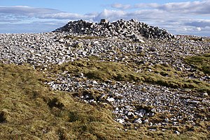
 The summit of Scaraben | |
| Summit: | 2,054 feet ND066268 58°13’13"N, 3°35’30"W |
Scaraben is a mountain in southern Caithness, close to the bounds of Siutherland and the North Sea coast. It rises between the valleys of the Berriedale Water to the north and the Langwell Water to the south.
Scaraben forms an east-west ridge with three tops; the main top at 2,054 feet, flanked by Sròn Gharbh (1,995 feet) and East Scaraben (1,939 feet).
Caithness is generally a low-lying county, and its only mountains of any height are at its southern part; the county top, Morven (2,316 feet) is just four miles to the northwest of Scaraben.
Outside links
| ("Wikimedia Commons" has material about Scaraben) |
