Ettrick Pen: Difference between revisions
Jump to navigation
Jump to search
Created page with "{{Infobox hill |name=Ettrick Pen |county 1=Dumfriesshire |county 2=Selkirkshire |range=Ettrick Hills |picture=Ettrick Pen - geograph.org.uk - 29631.jpg |picture caption=Ettric..." |
No edit summary |
||
| Line 11: | Line 11: | ||
|longitude=-3.263770 | |longitude=-3.263770 | ||
}} | }} | ||
'''Ettrick Pen''' is a mountain of 2,269 feet on the border of [[Dumfriesshire]] and [[Selkirkshire]]. It is | '''Ettrick Pen''' is a mountain of 2,269 feet on the border of [[Dumfriesshire]] and [[Selkirkshire]]. It is the highest of the [[Ettrick Hills]], part of the [[Southern Uplands]]. | ||
The lower slopes of the mountain are crossed by the [[Southern Upland Way]], and an ascent of Ettrick Pen may be made from the way, climbing from Over Phawhope. | |||
The summit of the hill is crowned by a large and ancient cairn. | |||
Latest revision as of 13:36, 6 March 2015
| Ettrick Pen | |||
| Dumfriesshire, Selkirkshire | |||
|---|---|---|---|
 Ettrick Pen | |||
| Range: | Ettrick Hills | ||
| Summit: | 2,269 feet NT199076 55°21’23"N, 3°15’50"W | ||
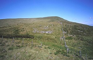
Ettrick Pen is a mountain of 2,269 feet on the border of Dumfriesshire and Selkirkshire. It is the highest of the Ettrick Hills, part of the Southern Uplands.
The lower slopes of the mountain are crossed by the Southern Upland Way, and an ascent of Ettrick Pen may be made from the way, climbing from Over Phawhope.
The summit of the hill is crowned by a large and ancient cairn.