Boyn Hill: Difference between revisions
Jump to navigation
Jump to search
Created page with "{{Infobox town |name=Boyn Hill |county=Berkshire |picture=Boyn Hill - geograph.org.uk - 1419054.jpg |picture caption=All Saints Church, Boyn Hill |os grid ref=SU8780 |latitude..." |
mNo edit summary |
||
| Line 4: | Line 4: | ||
|picture=Boyn Hill - geograph.org.uk - 1419054.jpg | |picture=Boyn Hill - geograph.org.uk - 1419054.jpg | ||
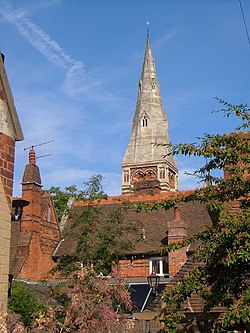
|picture caption=All Saints Church, Boyn Hill | |picture caption=All Saints Church, Boyn Hill | ||
|os grid ref= | |os grid ref=SU877808 | ||
|latitude=51. | |latitude=51.519899 | ||
|longitude=- | |longitude=-0.736722 | ||
|population= | |population= | ||
|post town= | |post town= | ||
|postcode= | |postcode=SL6 | ||
|dialling code= | |dialling code= | ||
|LG district=Windsor and Maidenhead | |LG district=Windsor and Maidenhead | ||
Latest revision as of 22:14, 18 November 2014
| Boyn Hill | |
| Berkshire | |
|---|---|
 All Saints Church, Boyn Hill | |
| Location | |
| Grid reference: | SU877808 |
| Location: | 51°31’12"N, -0°44’12"W |
| Data | |
| Postcode: | SL6 |
| Local Government | |
| Council: | Windsor and Maidenhead |
Boyn Hill is a Berkshire village which has grown into a suburb of Maidenhead.
It is located west of the town centre, between the A4 and the railway.

This Berkshire article is a stub: help to improve Wikishire by building it up.