Difference between revisions of "Arney"
From Wikishire
(Created page with '{{Infobox town |name=Arney |county=Fermanagh |picture= |picture caption= |os grid ref=H2138 |LG district=Fermanagh }} '''Arney''' is a village in Fermanagh. {{stub}}') |
|||
| Line 1: | Line 1: | ||
| − | {{Infobox town | + | {{Infobox town |
|name=Arney | |name=Arney | ||
|county=Fermanagh | |county=Fermanagh | ||
| − | |picture= | + | |picture=Arney RC Church - geograph.org.uk - 492373.jpg |
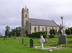
| − | |picture caption= | + | |picture caption=Arney Roman Catholic church |
| − | |os grid ref= | + | |os grid ref=H215386 |
| − | |LG district=Fermanagh | + | |latitude=54.296141 |
| + | |longitude=-7.670259 | ||
| + | |population=114 | ||
| + | |census year=2001 | ||
| + | |post town= | ||
| + | |postcode=BT32 | ||
| + | |dialling code=028 | ||
| + | |LG district=Fermanagh and Omagh | ||
| + | |constituency=Fermanagh and South Tyrone | ||
| + | |website= | ||
}} | }} | ||
| − | '''Arney''' is a village in [[Fermanagh]] | + | '''Arney''' is a small village in [[Fermanagh]], to the southwest of [[Enniskillen]], between the village of [[Bellanaleck]] and the Five Points crossroads |
| − | {{ | + | Arney takes its name from the [[Arney River]] that feeds [[Upper Lough Erne|Lough Erne]]. It had a population of 114 people (along with [[Skea, Fermanagh|Skea]]) in the 2001 census. |
| + | |||
| + | ==References== | ||
| + | {{reflist}} | ||
Latest revision as of 13:49, 9 December 2020
| Arney | |
| Fermanagh | |
|---|---|
 Arney Roman Catholic church | |
| Location | |
| Grid reference: | H215386 |
| Location: | 54°17’46"N, 7°40’13"W |
| Data | |
| Population: | 114 (2001) |
| Postcode: | BT32 |
| Dialling code: | 028 |
| Local Government | |
| Council: | Fermanagh and Omagh |
| Parliamentary constituency: |
Fermanagh and South Tyrone |
Arney is a small village in Fermanagh, to the southwest of Enniskillen, between the village of Bellanaleck and the Five Points crossroads
Arney takes its name from the Arney River that feeds Lough Erne. It had a population of 114 people (along with Skea) in the 2001 census.