Pumlumon Fach: Difference between revisions
Jump to navigation
Jump to search
mNo edit summary |
mNo edit summary |
||
| Line 3: | Line 3: | ||
|county=Cardiganshire | |county=Cardiganshire | ||
|range=Cambrian Mountains | |range=Cambrian Mountains | ||
|picture=Northwest approach to Pumlumon Fach - geograph.org.uk - 656625.jpg | |||
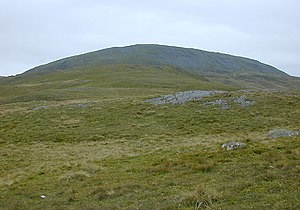
|picture caption=Northwest approach to Pumlumon Fach | |||
|height=2,192 feet | |height=2,192 feet | ||
|os grid ref=SN789869 | |os grid ref=SN789869 | ||
Revision as of 23:24, 29 October 2012
| Pumlumon Fach | |||
| Cardiganshire | |||
|---|---|---|---|
 Northwest approach to Pumlumon Fach | |||
| Range: | Cambrian Mountains | ||
| Summit: | 2,192 feet SN789869 | ||
Pumlumon Fach is a subsidiary top of Plynlimon on its high massif, a part of the Cambrian Mountains. Pumlumon Fach (which name means “Little Plynlimon”) rises to 2,192 feet in Cardiganshire. The summit is on small ridge heading north-west from the summit of Plynlimon itself (Pen Pumlumon Fawr).
The summit ogf Pumlumon Fach is marked by small cairn, and overlooks the Nant-y-moch Reservoir to the north and Llyn Llygad Rheidiol to the east.
The views from the top also include the smaller summits of Drosgol (1,804 feet) and Banc Llechwedd-mawr (1,837 feet) and Cwm Hyddgen, a hide-out of Owain Glyndŵr and his army in those troubled times.[1]
Outside links
References
- ↑ Nuttall, John & Anne (1999). The Mountains of England & Wales - Volume 1: Wales (2nd edition ed.). Milnthorpe, Westmorland: Cicerone. ISBN 1-85284-304-7.