Batford: Difference between revisions
Created page with '{{Infobox town |name=Batford |county=Hertfordshire |picture=Station Road Batford - geograph.org.uk - 585662.jpg |picture caption=Station Road, Batford |os grid ref=TL146156 |lati…' |
No edit summary |
||
| (One intermediate revision by one other user not shown) | |||
| Line 2: | Line 2: | ||
|name=Batford | |name=Batford | ||
|county=Hertfordshire | |county=Hertfordshire | ||
|picture= | |picture=Batford Mill - geograph.org.uk - 190894.jpg | ||
|picture caption= | |picture caption=Batford Mill | ||
|os grid ref=TL146156 | |os grid ref=TL146156 | ||
|latitude=51.82 | |latitude=51.82 | ||
|longitude=-00.34 | |longitude=-00.34 | ||
|population= | |population= | ||
|post town= | |post town=Harpenden | ||
|postcode= | |postcode=AL5 | ||
|dialling code=01582 | |dialling code=01582 | ||
|LG district=St Albans | |LG district=St Albans | ||
| Line 16: | Line 16: | ||
'''Batford''' is a village in [[Hertfordshire]] standing by the [[River Lea]] on the outskirts of [[Harpenden]]. | '''Batford''' is a village in [[Hertfordshire]] standing by the [[River Lea]] on the outskirts of [[Harpenden]]. | ||
It is a | It is a practical village with some small local shops, a petrol station, chip shop and two pubs, along with other local shops and some small factory units. | ||
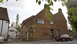
Batford Springs is a local nature reserve alongside the river and the village green which has a small play area for children. The large red brick building at the southern end of the village between the river and the Lower Luton Road was originally a water mill, it is now used as offices and the river has been diverted around the building. | Batford Springs is a local nature reserve alongside the river and the village green which has a small play area for children. The large red brick building at the southern end of the village between the river and the Lower Luton Road was originally a water mill, it is now used as offices and the river has been diverted around the building. | ||
Latest revision as of 21:00, 6 December 2017
| Batford | |
| Hertfordshire | |
|---|---|
 Batford Mill | |
| Location | |
| Grid reference: | TL146156 |
| Location: | 51°49’12"N, 0°20’24"W |
| Data | |
| Post town: | Harpenden |
| Postcode: | AL5 |
| Dialling code: | 01582 |
| Local Government | |
| Council: | St Albans |
| Parliamentary constituency: |
Hitchin and Harpenden |
Batford is a village in Hertfordshire standing by the River Lea on the outskirts of Harpenden.
It is a practical village with some small local shops, a petrol station, chip shop and two pubs, along with other local shops and some small factory units.
Batford Springs is a local nature reserve alongside the river and the village green which has a small play area for children. The large red brick building at the southern end of the village between the river and the Lower Luton Road was originally a water mill, it is now used as offices and the river has been diverted around the building.
Batford Methodist Church was built in 1905 and shows the distinctive "modern" architecture of that time.
During the Second World War a large prisoner of war camp was located in Batford adjoining what is now Common Lane and prisoners were present there until about 1947. When they had gone, the camp buildings were used to house local people who were waiting for housing which was in short supply at the time. Within a few years, a large housing estate was built on the site of the POW camp by the local authority.