Robertson Island: Difference between revisions
No edit summary |
No edit summary |
||
| Line 8: | Line 8: | ||
|longitude=-59.63 | |longitude=-59.63 | ||
|group= | |group= | ||
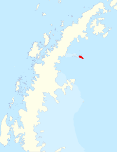
|map=Robertson Island location in Graham Land, BAT.svg | |||
|summit= | |summit= | ||
}} | }} | ||
Latest revision as of 17:41, 5 January 2024
- Not to be confused with Robertson Islands
| Robertson Island | |
| Location | |
| Location: | 65°10’15"S, 59°37’48"W |
| Data | |
Robertson Island is an ice-clad island, 13 miles long in a north-west to south-east direction and six miles wide, lying at the east end of the Seal Nunataks off the headland which divides the Nordenskjöld Coast to the south from the Oscar II Coast to the north, both part of the east coast of Graham Land in the British Antarctic Territory.
The island bounded by the Larsen Ice Shelf, except on the east coast, which breaks the ice front.
Captain Carl Anton Larsen discovered Robertson Island from the Jason on 9 December 1893.[1] Larsen named Robertson Island for William Robertson, a Bitish shipowner who was a co-owner of the Hamburg-based company Woltereck and Robertson, itself the main shareholder in the Norwegian whaling and sealing company A/S Oceana, sponsors for the voyages of Larsen's ship Jason.
Curious to find out if the volcano he found was active, Larsen skied to the top from the north side of the island, later naming it 'Christensen Island' (believing it to be a separate island) after his long-time business partner and majority owner of the Jason, Christen Christensen.[2] It is now named 'Christensen Nunatak'.
The island and Christensen Nunatak were surveyed by the Swedish Antarctic Expedition in October 1902, and mapped as a single island. The north part of the island was resurveyed by the Falkland Islands Dependencies Survey from "Hope Bay" in August 1947, when it was concluded that Christensen Nunatak was part of the island.
Following further survey by the Falkland Islands Dependencies Survey from "Hope Bay" in 1953 and 1955, it was found that Larsen had been right all along: Robinson Island and Christensen Nunatak were correctly mapped as two separate islands.
An Argentine refuge hut "San Roque" was established by Argentine Army personnel from "Esperanza" at the south-east end of the island near Cape Marsh on 21 November 1956.
References
- ↑ Mills, William James (2003). Exploring Polar Frontiers A Historical Encyclopedia. ABC-CLIO. pp. 373. ISBN 1-57607-422-6. http://www.abc-clio.com/products/overview.aspx?productid=108815.
- ↑ Yelverton, David E. (2004). Quest for a phantom strait: the saga of the pioneer Antarctic Peninsula expeditions, 1897-1905. New York: Guildford. pp. Intro XII. ISBN 0-9548003-0-3. http://nla.gov.au/anbd.bib-an26542889.
- Gazetteer and Map of The British Antarctic Territory: Robertson Island
- Mills, William James (2003). Exploring Polar Frontiers A Historical Encyclopedia. London: ABC-CLIO Publishing. ISBN 1-57607-422-6.
- Yelverton, David E. (2004). Quest for a phantom strait : the saga of the pioneer Antarctic Peninsula expeditions, 1897-1905. New York: Guildford. pp. Intro XII. ISBN 0-9548003-0-3.
