Template:FP-Brough of Birsay: Difference between revisions
Jump to navigation
Jump to search
No edit summary |
No edit summary |
||
| Line 6: | Line 6: | ||
The island is accessible on foot at low tide by a largely natural causeway but otherwise is separated from the mainland by a 787-foot stretch of water at high tide: the Sound of Birsay. | The island is accessible on foot at low tide by a largely natural causeway but otherwise is separated from the mainland by a 787-foot stretch of water at high tide: the Sound of Birsay. | ||
A Norse village stood on this island once, but its remains have been partly removed by coastal erosion, and the cliffs are reinforced by concrete rip-rap to prevent further damage.}}<noinclude> | A Norse village stood on this island once, but its remains have been partly removed by coastal erosion, and the cliffs are reinforced by concrete rip-rap to prevent further damage.}}<noinclude>{{FP data}} | ||
Latest revision as of 19:07, 5 May 2021
 |
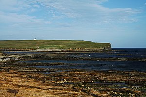
Brough of BirsayThe Brough of Birsay is an uninhabited tidal island off the northwest coast of the Mainland of Orkney, within the parish of Birsay. The island is accessible on foot at low tide by a largely natural causeway but otherwise is separated from the mainland by a 787-foot stretch of water at high tide: the Sound of Birsay. A Norse village stood on this island once, but its remains have been partly removed by coastal erosion, and the cliffs are reinforced by concrete rip-rap to prevent further damage. (Read more) |