Browtop: Difference between revisions
Jump to navigation
Jump to search
Created page with "{{Infobox town |name=Browtop |county=Cumberland |picture= |picture caption= |os grid ref=NY062250 |latitude=54.611465 |longitude=-3.453482 |population= |post town=Workington |..." |
No edit summary |
||
| Line 2: | Line 2: | ||
|name=Browtop | |name=Browtop | ||
|county=Cumberland | |county=Cumberland | ||
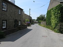
|picture= | |picture=Branthwaite, village lane (geograph 1927965).jpg | ||
|picture caption= | |picture caption= | ||
|os grid ref=NY062250 | |os grid ref=NY062250 | ||
Latest revision as of 21:44, 24 June 2017
| Browtop | |
| Cumberland | |
|---|---|

| |
| Location | |
| Grid reference: | NY062250 |
| Location: | 54°36’41"N, 3°27’13"W |
| Data | |
| Post town: | Workington |
| Postcode: | CA14 |
| Dialling code: | 01900 |
| Local Government | |
| Council: | Cumberland |
| Parliamentary constituency: |
Copeland |
Browtop is a village in Cumberland, on the east bank of the River Marron, joined by a bridge to Branthwaite on the opposite bank.

This Cumberland article is a stub: help to improve Wikishire by building it up.