Dewar Nunatak: Difference between revisions
Jump to navigation
Jump to search
No edit summary |
No edit summary |
||
| (One intermediate revision by the same user not shown) | |||
| Line 17: | Line 17: | ||
{{Reflist}} | {{Reflist}} | ||
*{{ | *{{basgaz}} | ||
[[Category:Nunataks of | [[Category:Nunataks of Adelaide Island]] | ||
Latest revision as of 09:52, 5 December 2022
| Dewar Nunatak | |||
| British Antarctic Territory | |||
|---|---|---|---|
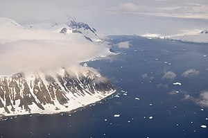
 Adelaide Island's east coastwith Dewar Nunatak the lone mountain at extreme top right | |||
| Adelaide Island | |||
| Summit: | 1,706 feet 67°19’60"S, 68°15’0"W | ||
Dewar Nunatak is a mainly snow-covered hill rising to 1,706 feet in the middle of Shambles Glacier, on the east coast of Adelaide Island, off Graham Land. It is classed as a ‘nunatak’: a rock formation projecting above the ice.
The place was named by the UK Antarctic Place-Names Committee in 1963 for Graham J.A. Dewar, a British Antarctic Survey geologist at Adelaide station, 1961–63.
References
- Gazetteer and Map of The British Antarctic Territory: Dewar Nunatak