Bagenalstown: Difference between revisions
mNo edit summary |
m clean up |
||
| Line 25: | Line 25: | ||
Near Muine Bheag is [[Ballyloughan Castle]], which comprises a twin-towered gatehouse and the hall and foundations of one of the corner towers of a large castle dating from about 1300.<ref>{{cite web | title=Ballyloughan Castle | work=Carlow Tourism – Castles | url=http://www.carlowtourism.com/castles.html | accessdate=9 December 2007}}</ref> | Near Muine Bheag is [[Ballyloughan Castle]], which comprises a twin-towered gatehouse and the hall and foundations of one of the corner towers of a large castle dating from about 1300.<ref>{{cite web | title=Ballyloughan Castle | work=Carlow Tourism – Castles | url=http://www.carlowtourism.com/castles.html | accessdate=9 December 2007}}</ref> | ||
[[Ballymoon Castle]] is | [[Ballymoon Castle]] is two miles east of Bagenalstown, and is thought to date from the 13th century.<ref>{{cite web | title=Ballymoon Castle, County Carlow | work=Irelands Eye.com | url=http://www.irelandseye.com/aarticles/travel/attractions/castles/ballymc.shtm | accessdate=10 December 2007}}</ref> | ||
==Big Society== | ==Big Society== | ||
| Line 48: | Line 48: | ||
The town is on the [[River Barrow]]. It is at the junction of the R705 and R724 regional roads and stands to the eastern side of the R448. | The town is on the [[River Barrow]]. It is at the junction of the R705 and R724 regional roads and stands to the eastern side of the R448. | ||
Bagenalstown is connected to the railway network on the [[Dublin]] – [[Kilkenny]] section of the Dublin-Waterford railway line, which connects the town to nearby Carlow, as well as Kilkenny to the | Bagenalstown is connected to the railway network on the [[Dublin]] – [[Kilkenny]] section of the Dublin-Waterford railway line, which connects the town to nearby Carlow, as well as Kilkenny to the south-west. | ||
The railway station was opened on 24 July 1848 as 'Bagnalstown'. In 1910 it was renamed 'Bagenalstown'. The station was closed to passenger taffic in 1963 and permanently closed for goods traffic on 6 September 1976.<ref>[http://www.railscot.co.uk/Ireland/Irish_railways.pdf Bagenalstown station] - Railscot – Irish Railways]</ref> In 1988 the station reopened, but named 'Muine Bheag'. | The railway station was opened on 24 July 1848 as 'Bagnalstown'. In 1910 it was renamed 'Bagenalstown'. The station was closed to passenger taffic in 1963 and permanently closed for goods traffic on 6 September 1976.<ref>[http://www.railscot.co.uk/Ireland/Irish_railways.pdf Bagenalstown station] - Railscot – Irish Railways]</ref> In 1988 the station reopened, but named 'Muine Bheag'. | ||
Latest revision as of 12:01, 2 August 2017
| Bagenalstown Irish: Muine Bheag | |
| County Carlow | |
|---|---|
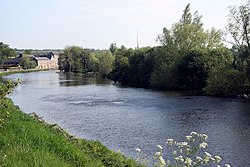
 The River Barrow in Bagenalstown | |
| Location | |
| Grid reference: | S683609 |
| Location: | 52°42’4"N, 6°57’25"W |
| Data | |
| Population: | 2,532 (2006) |
| Local Government | |
Bagenalstown is a small town on the River Barrow in County Carlow. It is also known for official purposes by the Irish language name Muine Bheag.
History and name
The town sprang up within the townland of Moneybeg, a name which comes the Irish Muine Bheag, meaning "Small thicket",[1] whence the Irish name of the town. In the 18th century there was a small hamlet at Muine Bheag.
Walter Bagenal, later Lord Walter Bagenal, decided to build a town on the site, named 'New Versailles' and ambitiously modelled after Versailles in France.[2] However, shortly after the building began the coach route from Dublin was changed so that coaches now crossed the River Barrow at Leighlinbridge instead.[2] Bagenal abandoned his plans, having built only a courthouse.[2] It was not until the arrival of the railway in 1846 that the settlement began to grow into a town.[2]
The town created by Bagenal was named 'Bagenalstown'. Following the creation of the Irish Free State the Town Commission sought to Gaelicize names across the state and in 1932 the Commission officially named Bagenalstown 'Muinebheag', though without consulting the townsfolk, who continued to call it Bagenalstown. In 1975 the local council held a plebiscite on the matter and the majority of votes came out for 'Bagenalstown', but the total poll turn-out was only 50%, which was below the 75% threshold required to change the official designation.
The motto on the town's coat of arms is The Irrepressible Number and its Irish equivalent Uimhir Gan Choisc.
About the town
Near Muine Bheag is Ballyloughan Castle, which comprises a twin-towered gatehouse and the hall and foundations of one of the corner towers of a large castle dating from about 1300.[3]
Ballymoon Castle is two miles east of Bagenalstown, and is thought to date from the 13th century.[4]
Big Society
The 1st Bagenalstown BP Scout Group was established in 2009 and meets in the McGrath hall. Their activities include hiking, camping, kayaking and games. In 2011 the troop became the first in the history of the state to stay in an Army barracks.[5]
Muine Bheag hosts a floral festival every August.
Sport
- Hurling: Muine Bheag/Erin's Own
- Gaelic football club: Saint Andrew's.
- Soccer:
- Bagenalstown FC
- Kilree Celtic
- Cricket: Bagenalstown Cricket Club, first formed in 1843 by the local millers, and is still in use. The club's logo is a grinding wheel, which was used in early milling.
There is a swimming pool on the approach road to the town from Leighlinbridge.
The racehorse Danoli, described in 1995 as "the most popular racehorse in Ireland"[6] was trained near the town by Thomas Foley.
Transport

The town is on the River Barrow. It is at the junction of the R705 and R724 regional roads and stands to the eastern side of the R448.
Bagenalstown is connected to the railway network on the Dublin – Kilkenny section of the Dublin-Waterford railway line, which connects the town to nearby Carlow, as well as Kilkenny to the south-west.
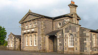
The railway station was opened on 24 July 1848 as 'Bagnalstown'. In 1910 it was renamed 'Bagenalstown'. The station was closed to passenger taffic in 1963 and permanently closed for goods traffic on 6 September 1976.[7] In 1988 the station reopened, but named 'Muine Bheag'.
Outside links
| ("Wikimedia Commons" has material about Bagenalstown) |
References
- ↑ "Why rail is the way to go | Munster Express Online". Munster-express.ie. 2008-03-14. http://www.munster-express.ie/opinion/to-be-honest/why-rail-is-the-way-to-go/. Retrieved 2012-07-21.
- ↑ 2.0 2.1 2.2 2.3 Mayse, Shirley. Our Caswell Relatives. University of Wisconsin, 1975. p.343
- ↑ "Ballyloughan Castle". Carlow Tourism – Castles. http://www.carlowtourism.com/castles.html. Retrieved 9 December 2007.
- ↑ "Ballymoon Castle, County Carlow". Irelands Eye.com. http://www.irelandseye.com/aarticles/travel/attractions/castles/ballymc.shtm. Retrieved 10 December 2007.
- ↑ http://www.bagenalstownparish.ie/2011/03/tuesday-march-29-2011/
- ↑ Mallon, Brian (1995-04-11). "Danoli's career still in balance after operation". The Independent. http://www.independent.co.uk/sport/danolis-career-still-in-balance-after-operation-1615241.html. Retrieved 2012-07-21.
- ↑ Bagenalstown station - Railscot – Irish Railways]
