Craigton, Angus: Difference between revisions
Jump to navigation
Jump to search
Created page with "{{Infobox town |name=Craigton |county=Angus |picture=View of Craigton of Airlie Village - geograph.org.uk - 1203428.jpg |population= |census year= |os grid ref=NO511381 |latit..." |
m Wrong Craigton |
||
| Line 2: | Line 2: | ||
|name=Craigton | |name=Craigton | ||
|county=Angus | |county=Angus | ||
|picture= | |picture=Fields at Craigton, Angus - geograph-3562693-by-Douglas-Nelson.jpg | ||
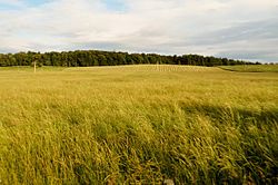
|picture caption=Fields at Craigton | |||
|population= | |population= | ||
|census year= | |census year= | ||
Latest revision as of 20:40, 16 September 2014
| Craigton | |
| Angus | |
|---|---|
 Fields at Craigton | |
| Location | |
| Grid reference: | NO511381 |
| Location: | 56°31’56"N, 2°47’48"W |
| Data | |
| Post town: | Dundee |
| Postcode: | DD5 |
| Dialling code: | 01382 |
| Local Government | |
| Council: | Angus |
| Parliamentary constituency: |
Dundee East |
Craigton is a village in Angus. It lies to the north of the Downie Hills, approximately three miles north of Carnoustie.
Immediately to the west of the village lie the reservoirs of Monikie Country Park, and to the south is the Panmure Testimonial.
References

This Angus article is a stub: help to improve Wikishire by building it up.