Botany Bay, Monmouthshire: Difference between revisions
Jump to navigation
Jump to search
No edit summary |
m clean up, typos fixed: of of → of |
||
| Line 15: | Line 15: | ||
|constituency=Monmouth | |constituency=Monmouth | ||
}} | }} | ||
'''Botany Bay''' is a hamlet in eastern [[Monmouthshire]]. It is located in the [[Wye Valley]] north-west | '''Botany Bay''' is a hamlet in eastern [[Monmouthshire]]. It is located in the [[Wye Valley]] north-west of [[Tintern]] and south-east of [[Catbrook]]. | ||
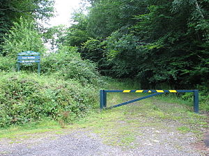
[[File:Botany Bay - track through Coed Beddick wood - geograph.org.uk - 494210.jpg|thumb|left|The track through Coed Beddick wood ]] | [[File:Botany Bay - track through Coed Beddick wood - geograph.org.uk - 494210.jpg|thumb|left|The track through Coed Beddick wood]] | ||
{{stub}} | {{stub}} | ||
Latest revision as of 17:30, 28 January 2016
| Botany Bay | |
| Monmouthshire | |
|---|---|
| Location | |
| Grid reference: | SO5291102047 |
| Location: | 51°42’53"N, 2°40’54"W |
| Data | |
| Post town: | Chepstow |
| Postcode: | NP16 |
| Dialling code: | 01291/01600 |
| Local Government | |
| Council: | Monmouthshire |
| Parliamentary constituency: |
Monmouth |
Botany Bay is a hamlet in eastern Monmouthshire. It is located in the Wye Valley north-west of Tintern and south-east of Catbrook.


This Monmouthshire article is a stub: help to improve Wikishire by building it up.