Strangford Lough: Difference between revisions
mNo edit summary |
No edit summary |
||
| (3 intermediate revisions by 2 users not shown) | |||
| Line 1: | Line 1: | ||
{{county|Down}} | |||
[[File:Strangford Lough (03), August 2009.JPG|right|thumb|300px|Strangford Lough and Pier at Castle Ward, Strangford]] | [[File:Strangford Lough (03), August 2009.JPG|right|thumb|300px|Strangford Lough and Pier at Castle Ward, Strangford]] | ||
'''Strangford Lough''' is a tidal lough in [[County Down]]. It is separated from the [[Irish Sea]] by the [[Ards Peninsula]], and joined at the narrows between the village of [[Strangford]] and [[Portaferry]]. It is the largest inlet in the [[British Isles]], covering 58 square miles. | '''Strangford Lough''' is a tidal lough in [[County Down]]. It is separated from the [[Irish Sea]] by the [[Ards Peninsula]], and joined at the narrows between the village of [[Strangford]] and [[Portaferry]]. It is the largest inlet in the [[British Isles]], covering 58 square miles. | ||
| Line 41: | Line 42: | ||
==Ferry== | ==Ferry== | ||
[[File:Strangford Ferry (10), August 2009.JPG|thumb|right|220px|MV Portaferry II, August 2009]] | [[File:Strangford Ferry (10), August 2009.JPG|thumb|right|220px|MV Portaferry II, August 2009]] | ||
There has been a ferry service between [[Portaferry]] and [[Strangford]], without a break, for almost four centuries.<ref name="ferry">{{cite web| url=http://www.roadsni.gov.uk/index/strangfordferry/strangfordferry-history.htm| title=Strangford Lough Ferry - History| publisher=Northern Ireland Roads Department| accessdate=13 September 2009}}</ref> The alternative road journey is | There has been a ferry service between [[Portaferry]] and [[Strangford]], without a break, for almost four centuries.<ref name="ferry">{{cite web| url=http://www.roadsni.gov.uk/index/strangfordferry/strangfordferry-history.htm| title=Strangford Lough Ferry - History| publisher=Northern Ireland Roads Department| accessdate=13 September 2009}}</ref> The alternative road journey is 47 miles and takes about an hour and a half, while the ferry crosses the 0.6 nautical miles in 8 minutes.<ref>{{cite web| url=http://www.roadsni.gov.uk/index/strangfordferry/strangfordferry-about.htm| title=About the Ferry| publisher=Northern Ireland Roads Department| accessdate=13 September 2009}}</ref> A new £2.7 million vessel, MV Portaferry II, came into service on 18 December 2001. | ||
==Archaeology== | ==Archaeology== | ||
| Line 47: | Line 48: | ||
==Outside links== | ==Outside links== | ||
*Location map: {{wmap|54.483|-5.583|zoom=11}} | |||
*[http://www.strangfordlough.org/ Strangford Lough Online] | *[http://www.strangfordlough.org/ Strangford Lough Online] | ||
*[http://www.marineturbines.com/ Marine Current Turbines] | *[http://www.marineturbines.com/ Marine Current Turbines] | ||
| Line 64: | Line 66: | ||
[[Category:County Down]] | [[Category:County Down]] | ||
[[Category:Sea loughs of County Down]] | |||
Latest revision as of 17:43, 10 June 2016
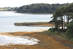
Strangford Lough is a tidal lough in County Down. It is separated from the Irish Sea by the Ards Peninsula, and joined at the narrows between the village of Strangford and Portaferry. It is the largest inlet in the British Isles, covering 58 square miles.
The Lough's name is from the Old Norse language, Strangr-fjorðr, menaing "strong fjord", whether by reference to its secure location or from the fast-flowing tide in the narrows. An ancient name for the narrows at the mouth of the lough was the Fretum Brene (called in some sources Vitaey fretum Brenasse).[1]
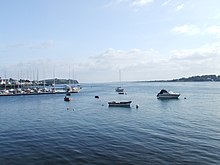
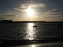
Strangford Lough is a popular tourist attraction, noted for its fishing and the picturesque villages and townships which border its waters. These include Portaferry on the Ards Peninsula, which is connected to Strangford across the lough by a car ferry.
The lough is studded with islands and islets. Almost totally landlocked, the lough is approached from the Irish Sea through the five-mile long fast-running tidal narrows, which open out into more gentle waters where there are found some 70 islands. Countless tidal rocky outcrops called "pladdies" litter the lough and mudflats, along with marshes, rocks, bays and headlands.
Nature
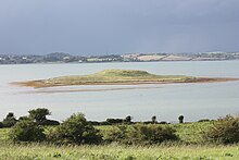
The lough is a conservation area and its abundant wildlife recognised internationally for its importance. Its coasts and islands are owned by the National Trust.
Birds and beasts
Strangford Lough is an important winter migration destination for many wading and sea birds.
Animals commonly found in the lough include common seals, basking sharks and Brent geese. Three quarters of the world population of pale bellied Brent geese winter in the lough.[2]
Plants
The rocky and boulder shores toward the south of the lough are dominated by the seaweed knotted wrack ascophyllum nodosum. The usual zonation of weeds on these shore is, at the top channel wrack, followed by spiral wrack, then knotted wrack with some admixture of bladder wrack and then serrated wrack before coming to the low water kelps.[3]
Maerl is a calcareous deposit, in the main, of two species, of calcareous algae phymatolithon calcareum and lithothamnion glaciale which form free-living beds of unattached, branched corallines, living or dead, in Strangford Lough.[4]
In 1995 a fiercely invasive brown seaweed species sargassum muticum, originating in the seas of Japan, was discovered on in Strangford Lough. The plants were well established on mesh oyster bags containing Pacific oysters (crassostrea gigas).[5][6]

Tidal electricity
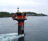
In 2007 Strangford Lough became home to the world's first commercial tidal stream power station, SeaGen. The 1.2 megawatt underwater tidal electricity generator takes advantage of the fast tidal flow in the lough which can be up to 4 ms-1. The generator is powerful enough to power up to a thousand homes, but the turbine has a minimal environmental impact, as it is almost entirely submerged, and the rotors turn slowly enough that they pose no danger to wildlife.[7][8][9]
Since June 2008 another tidal energy device called Evopod has been tested in Strangford Lough near the Portaferry Ferry landing.[10] The device is a 1/10th scale prototype and is being monitored by Queen's University Belfast. The device is a semi submerged floating tidal turbine and is moored to the seabed via a buoy mounted swivel so that it always maintains optimum heading into the direction of the tidal flow. The scale device is not grid connected and dissipates the small amount of power it generates as heat into the sea.
Activity on Strangford Lough
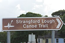
Strangford Lough is a place of natural beauty that the locals put to great use. From using it as a national highway (Portaferry-Strangford ferry) to using it for activities of leisure - sailing, kayaking, bird watching, diving and much more. There are a number of companies based in the local area encouraging visitors to explore the area including: Exploris Aquarium - where you can learn more about the lough and its wildlife; Clearsky Adventure Centre - kayaking, canoeing etc and DV diving. There are also canoe trails in place and a 'Strangford Lough Activity Map' has been launched as a part of a series of maps produced by the Ordnance Survey of Northern Ireland.
Ferry
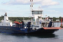
There has been a ferry service between Portaferry and Strangford, without a break, for almost four centuries.[11] The alternative road journey is 47 miles and takes about an hour and a half, while the ferry crosses the 0.6 nautical miles in 8 minutes.[12] A new £2.7 million vessel, MV Portaferry II, came into service on 18 December 2001.
Archaeology
Strangford Lough has a substantial archaeological heritage. Intertidal archaeological surveys in recent years have brought hundreds of sites to light, including fish traps, tidal mills, kelp walls and harbours and landing places.[13]
Outside links
- Location map: 54°28’59"N, 5°34’59"W
- Strangford Lough Online
- Marine Current Turbines
- Ocean Flow Energy
- Strangford Lough Imagery
- Strangford Lough Photos
- Clearsky Adventure Centre - provider of activities on the lough and water's edge
- St. Patrick: his life and mission
- JNCC Special Area of Conservation Selection
References
- ↑ II-Landing Places of St. Patrick, "Saint Patrick: his life and mission", Mrs Thomas Cannon, The Talbot Press Ltd., Dublin & Cork, From The James D. Phelan Celtic Collection
- ↑ BBC Hands on Nature
- ↑ Brown, R. 1990. Strangford Lough. The Wildlife of an Irish Sea Lough. The Institute of Irish Studies, The Queen's University of Belfast
- ↑ Blake,C. and Maggs, C.A. 2001. A study of maerl beds in Strangford Lough, including determination of growth rates. in Nunn, J.D. (ed). Marine Biodiversity in Ireland and Adjacent Waters. Ulster Museum, Belfast. MAGNI publication no. 008
- ↑ Boaden, P.J.S. 1995. The adventive seaweed Sargassum muticum (Yendo) Fensholt in Strangford Lough, Northern Ireland. Ir.Nat. J. 25:111 - 113
- ↑ Davison,D.M. 1999. Sargassum muticum in Strangford Lough, 1995 - 1998; a review of the introduction and colonisation of Strangford Lough MNR and cSAC by the invasive brown algae Sargassum muticum. Environment and Heritage Service Research and Development Series. No. 99/27.
- ↑ Turbine technology is turning the tides into power of the future
- ↑ SeaGen Turbine Installation Completed
- ↑ "Tidal energy system on full power". BBC News. 18 December 2008. http://news.bbc.co.uk/1/hi/northern_ireland/7790494.stm. Retrieved 13 September 2009.
- ↑ "First Testing of Evopod at Strangford Narrows". Ocean Flow Energy Ltd. 12 June 2008. http://www.oceanflowenergy.com/news-details.aspx?id=6. Retrieved 13 September 2009.
- ↑ "Strangford Lough Ferry - History". Northern Ireland Roads Department. http://www.roadsni.gov.uk/index/strangfordferry/strangfordferry-history.htm. Retrieved 13 September 2009.
- ↑ "About the Ferry". Northern Ireland Roads Department. http://www.roadsni.gov.uk/index/strangfordferry/strangfordferry-about.htm. Retrieved 13 September 2009.
- ↑ O'Sullivan, Aidan & Breen, Colin (2007). Maritime Ireland. An Archaeology of Coastal Communities. Stroud: Tempus. p. 16. ISBN 978-0-7524-2509-2.
Further reading
- Boaden, P.J.S., O'Connor, R.J. and Seed, R. 1975. The composition and zonation of a fucus serratus community in Strangford Lough, Co. Down. J. exp. Biol. Ecol. 17: 111 - 136.
- Walsh, B. 2009. Catching the Currents. Time 173 no.4. p. 44.