Cundall, Yorkshire: Difference between revisions
Jump to navigation
Jump to search
Created page with '{{Infobox town |name=Cundall |county=Yorkshire |riding=North |picture= |picture caption= |os grid ref=SE423726 |latitude=54.14785 |longitude=-1.35248 |population= |LG district=Ha…' |
mNo edit summary |
||
| Line 3: | Line 3: | ||
|county=Yorkshire | |county=Yorkshire | ||
|riding=North | |riding=North | ||
|picture= | |picture=Crossroads - Cundall village - geograph.org.uk - 320333.jpg | ||
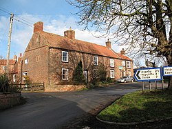
|picture caption= | |picture caption=Crossroads in Cundall | ||
|os grid ref=SE423726 | |os grid ref=SE423726 | ||
|latitude=54.14785 | |latitude=54.14785 | ||
Latest revision as of 21:35, 9 November 2012
| Cundall | |
| Yorkshire North Riding | |
|---|---|
 Crossroads in Cundall | |
| Location | |
| Grid reference: | SE423726 |
| Location: | 54°8’52"N, 1°21’9"W |
| Data | |
| Post town: | YORK |
| Postcode: | YO61 |
| Local Government | |
| Council: | Harrogate |
Cundall is a hamlet in the North Riding of Yorkshire. It is one of the Thankful Villages; those few which suffered no deaths amongst its men during the Great War of 1914 to 1918.

This Yorkshire article is a stub: help to improve Wikishire by building it up.