Kirkibost Island: Difference between revisions
Created page with '{{Infobox island |name=Kirkibost Island |gaelic=Eilean Chirceboist |county=Inverness-shire |map=Kirkibost OH.svg |picture=Kirkibost.jpg |picture caption=The southern tip of Kirki…' |
mNo edit summary |
||
| (One intermediate revision by the same user not shown) | |||
| Line 3: | Line 3: | ||
|gaelic=Eilean Chirceboist | |gaelic=Eilean Chirceboist | ||
|county=Inverness-shire | |county=Inverness-shire | ||
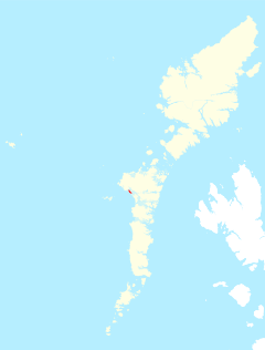
|map=Kirkibost OH.svg | |group=Outer Hebrides | ||
|map=Kirkibost Island OH.svg | |||
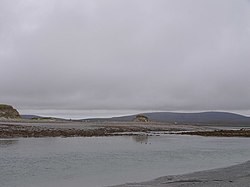
|picture=Kirkibost.jpg | |picture=Kirkibost.jpg | ||
|picture caption=The southern tip of Kirkibost Island | |picture caption=The southern tip of Kirkibost Island | ||
Latest revision as of 13:57, 4 August 2013
| Kirkibost Island Gaelic: Eilean Chirceboist | |
 The southern tip of Kirkibost Island | |
|---|---|
| Location | |
| Location: | 57°33’28"N, 7°26’11"W |
| Grid reference: | NF753649 |
| Area: | 506.6 acres |
| Highest point: | 213 feet |
| Data | |
| Population: | 0 |
Kirkibost is a low-lying island along the south-western shoreline of North Uist in the Outer Hebrides, belonging to Inverness-shire. It is divided from North Uist only by a sandy, tidal bay, Kirkivbost Bay, and at low tide the two are joined across the uncovered beach.
Geography
Kirkibost, along with neighbouring Baleshare, is covered by a machair system of coastal plains covered with shell sand, part covered by grass, with some sand dunes, fens and peat. Together with Baleshare, it forms part of a Site of Special Scientific Interest.[1]
Within the bay is a set of small islands; Eilean Mòr, Bior-eilean and Sròmaigh, all lying between Kirkibost and North Uist.
Wildlife
The island is important for corncrakes, various wading birds and overwintering wildfowl.[1]
Economy
Kirkibost has been cultivated in the past, but is now used only for seasonal cattle grazing.[1]
References
- ↑ 1.0 1.1 1.2 Scottish Natural Heritage (March 2002). "SSSI Management Statement: Baleshare & Kirkibost SSSI". http://gateway.snh.gov.uk/pls/portal/SNHTest_Site_Docs.Show_Site_Document?p_pa_code=121&p_Doc_Type_ID=3. Retrieved 2007-07-19.
