Larsen Islands: Difference between revisions
Jump to navigation
Jump to search
Created page with "right|thumb|250px|Location of the Larsen Islands {{territory|BAT}} The '''Larsen Islands''' are three islands and off-l..." |
(No difference)
|
Latest revision as of 15:27, 26 December 2023

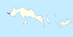
The Larsen Islands are three islands and off-lying rocks west of Coronation Island, to the north-west of the latter's Sandefjord Bay, amongst the South Orkney Islands in the British Antarctic Territory.
The largest of the islands is Monroe Island, and the main group of off-lying rocks are the Nicolas Rocks.
The islands were roughly charted by Powell and Palmer in December 1821. They were further charted by Sørlle in 1912 and named C.A. Larsen [sic] after Captain Carl Anton Larsen (from whom many features are named in the Territory and around South Georgia). The islands were further charted by Discovery Investigations in 1933. The log of the German Antarctic Expedition of 1873-74 records a landing made on 10 February 1874.
Location
- Location map: 60°40’59"S, 45°6’58"W
References
- Gazetteer and Map of The British Antarctic Territory: Larsen Islands