Beinn a' Chòin: Difference between revisions
Jump to navigation
Jump to search
Created page with "{{Infobox hill |name=Beinn a' Choin |county 1=Dunbartonshire |county 2=Stirlingshire |picture=On Beinn a' Choin - geograph.org.uk - 29730.jpg |picture caption=Beinn a' Choin's..." |
No edit summary |
||
| Line 12: | Line 12: | ||
|range=Trossachs | |range=Trossachs | ||
}} | }} | ||
'''Beinn a' Choin''' is a mountain of 2,523 feet on the border of [[Dunbartonshire]] with [[Stirlingshire]], in the northernmost, Highland reach of Dunbartonshire | '''Beinn a' Choin''' is a mountain of 2,523 feet on the border of [[Dunbartonshire]] with [[Stirlingshire]], in the northernmost, Highland reach of Dunbartonshire. | ||
The mountain stands at the northern end of [[Loch Lomond]], overlooking the loch below its western slope. | The mountain stands at the northern end of [[Loch Lomond]], overlooking the loch below its western slope. | ||
Latest revision as of 21:56, 31 August 2022
| Beinn a' Choin | |||
| Dunbartonshire, Stirlingshire | |||
|---|---|---|---|
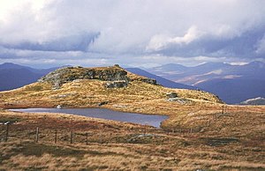
 Beinn a' Choin's summit | |||
| Range: | Trossachs Hills | ||
| Summit: | 2,523 feet NN354130 56°16’52"N, 4°39’36"W | ||
Beinn a' Choin is a mountain of 2,523 feet on the border of Dunbartonshire with Stirlingshire, in the northernmost, Highland reach of Dunbartonshire.
The mountain stands at the northern end of Loch Lomond, overlooking the loch below its western slope.
A rugged and wild mountain of rocks and moorland, it is to the north of Ben Lomond, and is usually climbed from the hamlet at of Inversnaid.[1]
References
- ↑ Beinn a' Choin: WalkHighlands