Oxenwood: Difference between revisions
No edit summary |
|||
| (6 intermediate revisions by 3 users not shown) | |||
| Line 7: | Line 7: | ||
|latitude=51.330455 | |latitude=51.330455 | ||
|longitude=-1.563907 | |longitude=-1.563907 | ||
|post town=Marlborough | |||
|postcode=SN8 | |||
|dialling code=01264 | |||
|LG district=Wiltshire | |LG district=Wiltshire | ||
}} | }} | ||
'''Oxenwood''' is a tiny village in [[Berkshire]] at the heart of a six-way junction of roads. It stands in the tail-end of Berkshire in the very | '''Oxenwood''' is a tiny village in [[Berkshire]] at the heart of a six-way junction of roads. It stands in the tail-end of Berkshire in the very south-west of the county, a part almost wholly surrounded by Wiltshire fields. To the north of Oxenwood is the hamlet of Rivar. | ||
The parish church is St Mary's, a fine | The parish church is St Mary's, a fine flint-built church which stands a mile from the centre of the village. | ||
Oxenwood village was originally all owned by the Fosbury Estate, centred on Fosbury House, at the east end of the village. The houses were built by the estate and estate workers originally occupied many of the houses. The village was largely rebuilt between 1862 and 1865 and the size of the village before the great rebuilding is not known. The village today is centred on six roads which meet at the present village green. | Oxenwood village was originally all owned by the Fosbury Estate, centred on Fosbury House, at the east end of the village. The houses were built by the estate and estate workers originally occupied many of the houses. The village was largely rebuilt between 1862 and 1865 and the size of the village before the great rebuilding is not known. The village today is centred on six roads which meet at the present village green. | ||
| Line 20: | Line 23: | ||
==The lie of the land== | ==The lie of the land== | ||
[[File:St. Mary's church, Oxenwood - geograph.org.uk - 861365.jpg|thumb|250px|St Mary's]] | |||
The six roads of Oxenwood, little lanes all, lead off like spokes of a wheel: | The six roads of Oxenwood, little lanes all, lead off like spokes of a wheel: | ||
| Line 36: | Line 40: | ||
==Rivar== | ==Rivar== | ||
[[File:Rivar - geograph.org.uk - 738328.jpg | [[File:Rivar - geograph.org.uk - 738328.jpg|thumb|250px|Rivar]] | ||
Rivar is a small hamlet to the north of Oxenwood at {{ | |||
Rivar is a small hamlet to the north of Oxenwood at {{wmap|51.352|-1.547|zoom=14}}, also in the narrow neck of Berkshire's south-western tail. | |||
==Border village== | ==Border village== | ||
Oxenwood since time immemorial formed part of the parish of [[ | Oxenwood has since time immemorial formed part of the ancient parish of [[Shalbourne]], a parish split between the two counties of [[Berkshire|Berks]] and [[Wiltshire|Wilts]], and of which the tything of Oxenwood was, and is, in Berkshire, while the rest of the parish was in Wiltshire. | ||
The tything of Oxenwood has never been a strictly detached part of Berkshire | The tything of Oxenwood has never been a strictly detached part of Berkshire, but is contiguous with the main body of the county. Nevertheless, it was suggested that it should considered part of Wiltshire for parliamentary purposes along with other detached parts so affected by the Parliamentary Boundaries Act 1832. Ultimately it was ascertained to be joined to Berks by a narrow neck and not included in that Act, or the Counties (Detached Parts) Act 1844 which followed it. | ||
==Outside links== | ==Outside links== | ||
*[http://www.oxenwoodcentre.co.uk/ Oxenwood Outdoor Education Centre] | *[http://www.oxenwoodcentre.co.uk/ Oxenwood Outdoor Education Centre] | ||
==References== | ==References== | ||
{{reflist}} | {{reflist}} | ||
[[Category:Extreme points of Berkshire]] | |||
Latest revision as of 11:51, 11 June 2020
| Oxenwood | |
| Berkshire | |
|---|---|
 Oxenwood | |
| Location | |
| Grid reference: | SU304591 |
| Location: | 51°19’50"N, 1°33’50"W |
| Data | |
| Post town: | Marlborough |
| Postcode: | SN8 |
| Dialling code: | 01264 |
| Local Government | |
| Council: | Wiltshire |
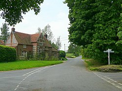
Oxenwood is a tiny village in Berkshire at the heart of a six-way junction of roads. It stands in the tail-end of Berkshire in the very south-west of the county, a part almost wholly surrounded by Wiltshire fields. To the north of Oxenwood is the hamlet of Rivar.
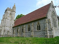
The parish church is St Mary's, a fine flint-built church which stands a mile from the centre of the village.
Oxenwood village was originally all owned by the Fosbury Estate, centred on Fosbury House, at the east end of the village. The houses were built by the estate and estate workers originally occupied many of the houses. The village was largely rebuilt between 1862 and 1865 and the size of the village before the great rebuilding is not known. The village today is centred on six roads which meet at the present village green.
Today though most of the houses are privately owned but Fosbury Hall stands proud on its own beside its creation.
At one time Oxenwood had public houses, a baker, a blacksmith, a shop and a sawyard. All these have now gone. There is a well near the centre of the village that is about 280 feet deep. It was last used in the 1930s.
The lie of the land

The six roads of Oxenwood, little lanes all, lead off like spokes of a wheel:
- To Rivar, up the scarp of Rivar Down and thence to Shalbourne
- To a track leading up on Smay Down
- To Fosbury hamlet and up to Oakhill Wood
- Becoming a track up Round Hill and to Haydown Hill
- To Tidcombe, to Marten and to the Roman road up Tidcombe Down
- Up Boley Down (part of Rivar Down) and thence to Great Bedwyn
The land underlying the village is upper chalk with evidence of the river alluvium, with a great deal of flint. This has informed the look of the village, many houses and the parish church being built of or faced with local flint.
Oxenwood lies in a great loop of hills, standing in the rolling bowl between the slopes, and Oxenwood itself is at about 590 feet above sea level. To the south, Tidcombe Down rises up to Haydown Hill, on which an ancient hill fort was built. The steep scarp of Rivar Down curves round from the west to the north and on into Hampshire, a ridge which become the North Downs. The Wayfarer's Path runs along this ridge (Berkshire's highest point, Walbury Hill is just four miles away from Oxenwood along this ridge path.)
The Oxenwood Outdoor Education Centre is here, a field studies centre teaching outdoor skills to youngsters.
Rivar

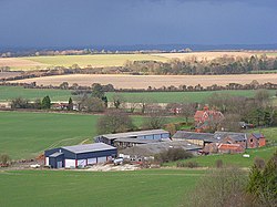
Rivar is a small hamlet to the north of Oxenwood at 51°21’7"N, 1°32’49"W, also in the narrow neck of Berkshire's south-western tail.
Border village
Oxenwood has since time immemorial formed part of the ancient parish of Shalbourne, a parish split between the two counties of Berks and Wilts, and of which the tything of Oxenwood was, and is, in Berkshire, while the rest of the parish was in Wiltshire.
The tything of Oxenwood has never been a strictly detached part of Berkshire, but is contiguous with the main body of the county. Nevertheless, it was suggested that it should considered part of Wiltshire for parliamentary purposes along with other detached parts so affected by the Parliamentary Boundaries Act 1832. Ultimately it was ascertained to be joined to Berks by a narrow neck and not included in that Act, or the Counties (Detached Parts) Act 1844 which followed it.