Chesters Hill Fort: Difference between revisions
Jump to navigation
Jump to search
Only one East Lothian! |
|||
| (2 intermediate revisions by the same user not shown) | |||
| Line 22: | Line 22: | ||
*Maps: | *Maps: | ||
**Location map: {{wmap| 55.993581|-2.790614}} | **Location map: {{wmap|55.993581|-2.790614|zoom=14}} | ||
**OS map: {{map|NT50697812}} | **OS map: {{map|NT50697812}} | ||
[[Category:Hill forts in East Lothian]] | [[Category:Hill forts in East Lothian]] | ||
[[Category:Historic Scotland | [[Category:Historic Scotland sites in East Lothian]] | ||
Latest revision as of 17:55, 18 February 2019

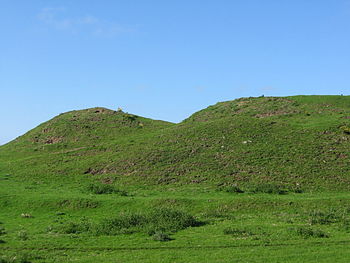
Chesters Hill Fort is an Iron Age hill fort in East Lothian. It is to be found one mile south of Drem and a mile and a half east of Ballencrieff Castle. The county town, Haddington, is two and a half miles off. The name "Chesters" comes from the Old English ceaster (ultimately from the Latin castra); a fortified place.
This fortified village with its system of ramparts and ditches around a settlement of about twenty roundhouses is in the care of Historic Scotland, who describe it as "one of the best-preserved examples in Scotland of an Iron age fort".[1]
The hillfort was subject to a detailed programme of survey by Rampart Scotland.[2]
Pictures
References
- Maps:
- Location map: 55°59’37"N, 2°47’26"W
- OS map: NT50697812


