Craigairie Fell: Difference between revisions
No edit summary |
No edit summary |
||
| (One intermediate revision by one other user not shown) | |||
| Line 7: | Line 7: | ||
|range=Galloway Hills | |range=Galloway Hills | ||
|os grid ref=NX236736 | |os grid ref=NX236736 | ||
}} | |latitude=55.0256 | ||
|longitude=-4.7611}} | |||
'''Craigairie Fell''' or '''Craig Airie Fell''' is the highest hill in [[Wigtownshire]]. Its name has been debated; one suggestion is that it comes from the Gaelic ''Creag aodhaire'' meaning "the shepherd's crag". | '''Craigairie Fell''' or '''Craig Airie Fell''' is the highest hill in [[Wigtownshire]]. Its name has been debated; one suggestion is that it comes from the Gaelic ''Creag aodhaire'' meaning "the shepherd's crag". | ||
The fell stands in the north of Wigtownshire close by the [[Ayrshire]] border, in the midst of a pine forest which coats the fell, all but the highest stretch, and much of the landscape of the county, a part of the [[Arecleogh Forest]] of Ayrshire. | The fell stands in the north of Wigtownshire close by the [[Ayrshire]] border, in the midst of a pine forest which coats the fell, all but the highest stretch, and much of the landscape of the county, a part of the [[Arecleogh Forest]] of Ayrshire. | ||
A mile to the north of Craigaire Fell's summit is that of Benbrake Hill, also within the forest, which stands barely shorter than Craigaire, at 1,024 feet; these two are the only hills above a thousand feet in Wigtownshire. | A mile to the north of Craigaire Fell's summit is that of [[Benbrake Hill]], also within the forest, which stands barely shorter than Craigaire, at 1,024 feet; these two are the only hills above a thousand feet in Wigtownshire. | ||
The Southern Upland Way winds by Craigaire Fell. The nearest road to reach the fell is the narrow road to Polbae climbing up from [[Knowe, Wigtownshire]] on the B7027, and from Polbae to take the Southern Upland Way westwards. | The Southern Upland Way winds by Craigaire Fell. The nearest road to reach the fell is the narrow road to Polbae climbing up from [[Knowe, Wigtownshire]] on the B7027, and from Polbae to take the Southern Upland Way westwards. | ||
==References== | ==References== | ||
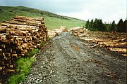
[[File:Towards Craig Airie Fell - geograph.org.uk - 633264.jpg|left|180px|Road to Craigaire Fell]] | [[File:Towards Craig Airie Fell - geograph.org.uk - 633264.jpg|thumb|left|180px|Road to Craigaire Fell]] | ||
{{reflist}} | {{reflist}} | ||
[[Category:County tops]] | [[Category:County tops]] | ||
Latest revision as of 19:15, 10 March 2018
| Craigairie Fell | |||
| Wigtownshire | |||
|---|---|---|---|
 Craigairie Fell | |||
| Range: | Galloway Hills | ||
| Summit: | 1,056 feet NX236736 55°1’32"N, 4°45’40"W | ||
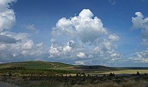
Craigairie Fell or Craig Airie Fell is the highest hill in Wigtownshire. Its name has been debated; one suggestion is that it comes from the Gaelic Creag aodhaire meaning "the shepherd's crag".
The fell stands in the north of Wigtownshire close by the Ayrshire border, in the midst of a pine forest which coats the fell, all but the highest stretch, and much of the landscape of the county, a part of the Arecleogh Forest of Ayrshire.
A mile to the north of Craigaire Fell's summit is that of Benbrake Hill, also within the forest, which stands barely shorter than Craigaire, at 1,024 feet; these two are the only hills above a thousand feet in Wigtownshire.
The Southern Upland Way winds by Craigaire Fell. The nearest road to reach the fell is the narrow road to Polbae climbing up from Knowe, Wigtownshire on the B7027, and from Polbae to take the Southern Upland Way westwards.
References
