Catcott Burtle: Difference between revisions
Jump to navigation
Jump to search
Created page with '{{Infobox town |name=Catcott Burtle |county=Somerset |picture= |picture= |os grid ref= ST402431 |latitude= 51.184051 |longitude=-2.856730 |post town=Bridgwater |postcode=TA7 |dia…' |
mNo edit summary |
||
| (2 intermediate revisions by 2 users not shown) | |||
| Line 2: | Line 2: | ||
|name=Catcott Burtle | |name=Catcott Burtle | ||
|county=Somerset | |county=Somerset | ||
|picture= | |picture= | ||
|os grid ref= ST402431 | |os grid ref= ST402431 | ||
Latest revision as of 21:47, 8 June 2016
| Catcott Burtle | |
| Somerset | |
|---|---|
| Location | |
| Grid reference: | ST402431 |
| Location: | 51°11’3"N, 2°51’24"W |
| Data | |
| Post town: | Bridgwater |
| Postcode: | TA7 |
| Dialling code: | 01278 |
| Local Government | |
| Council: | Sedgemoor |
| Parliamentary constituency: |
Bridgwater & W. Somerset |
Catcott Burtle is a hamlet in Somerset lying at the border of the parishes of Catcott and Burtle. It is found at the meeting of fen roads deep in the Somerset Levels, and the landscape all around it is of that extremity of character: flat green, broad acres.
The hamlet is at the meeting of Catcott Broad Drove and Westhay Broad Drove, just east of Burtle, which it has somewhat surpassed as a village.
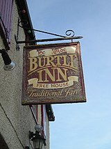
Catcott Burtle but one farm, one guesthouse and a pub, and a scattering of cottages along the roads.
